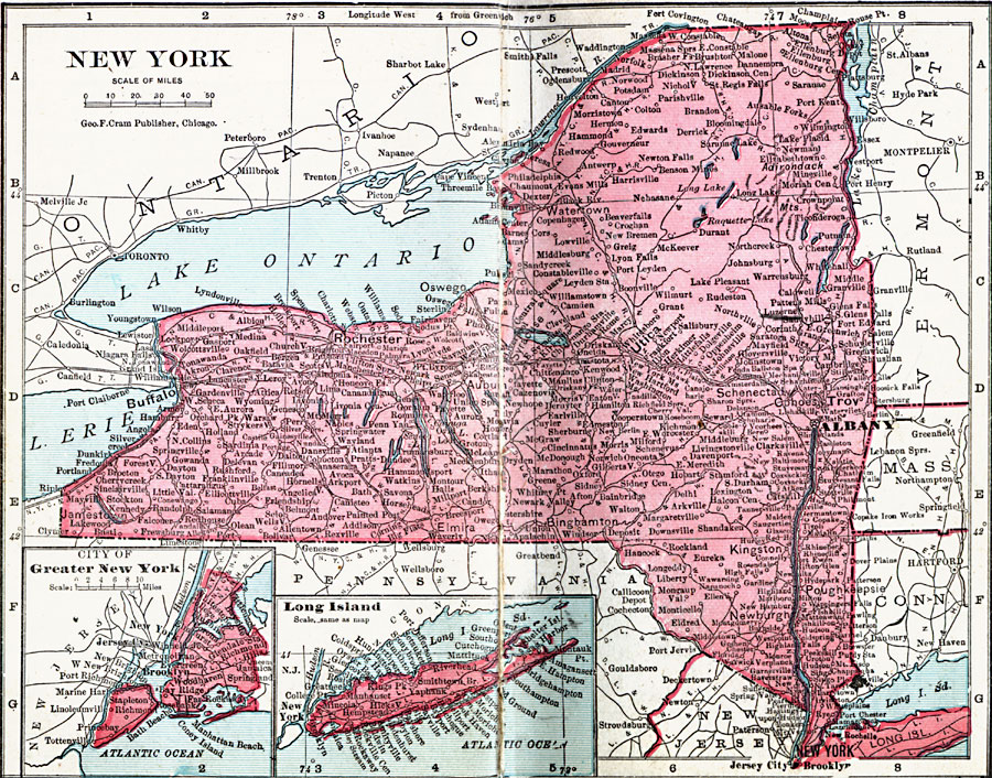
Description: A map from 1906 of New York showing the capital of Albany, principal cities and towns, railroads, canals, lakes, and rivers. Inset maps detail Greater New York City and Long Island.
Place Names: New York, Albany, �Brooklyn, �Buffalo, �Kingston, �New York City, �Oswego, �Rochester, �Syracuse, �Troy, �Utic
ISO Topic Categories: boundaries,
inlandWaters,
location,
oceans
Keywords: New York, physical, �political, �borders, �boundaries, �physical features, country borders, boundaries,
inlandWaters,
location,
oceans, Unknown, 1906
Source: George F. Cram , Cram's Quick Reference Atlas and Gazetteer of the World (Chicago , IL: George F. Cram Series of Atlases, 1906) 16
Map Credit: Courtesy the private collection of Roy Winkelman |
|