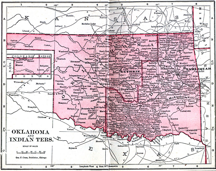
Description: A map from 1906 of the Indian Territory and Oklahoma Territory prior to statehood (November 16, 1907), showing the boundary between the territories, the territorial capitals of Tahlequah (Indian Territory) and Guthrie (Oklahoma Territory), principal cities and towns, railroads, and rivers.
Place Names: Oklahoma, Ardmore, �Chickasha, �Enid, �Lawton, �McAlester, �Oklahoma City, �Perry, �Shawnee, �Tulsa, �Wagone
ISO Topic Categories: boundaries,
inlandWaters,
location,
oceans
Keywords: Oklahoma and Indian Territories, physical, �political, �borders, �boundaries, kNativeAmerican, physical features, country borders, boundaries,
inlandWaters,
location,
oceans, Unknown, 1906
Source: George F. Cram , Cram's Quick Reference Atlas and Gazetteer of the World (Chicago , IL: George F. Cram Series of Atlases, 1906) 37
Map Credit: Courtesy the private collection of Roy Winkelman |
|