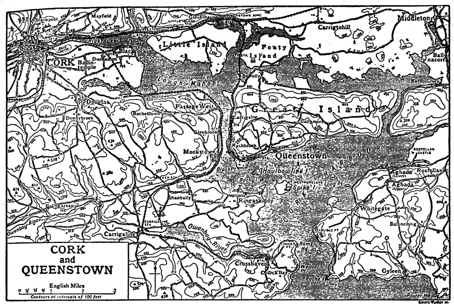
Description: This is a detailed map of the counties Corks and Queenstown in Ireland. It has contour lines showing elevation. It also shows all of the main towns, inland waters and railroads. "Cork, a county of Ireland in the province of Munster, bounded S. by the Atlantic Ocean, E. by the counties Waterford and Tipperary, N. by Limerick, and W. by Kerry. It is the largest county in Ireland, having an area of 1,849,686 acres, or about 2,890 square miles." — The Encyclopedia Britannica, 1910
Place Names: Ireland, Cork, �Queenstown, �Little Island, �Foaty Island, �Great Island, �Monkstown, �Carrigaline, �Whitegate, �Aghada, �Rostellan, �Lough Mahon, �Haulbowline, �Cork Harbour, �Ringaskiddy, �Crosshaven, �Middleton, �Carrigtohill, �Gyleen, �Owenboy River, �Dougl
ISO Topic Categories: boundaries,
inlandWaters,
transportation,
elevation
Keywords: Cork and Queenstown, physical, �political, �transportation, physical features,
topographical, major political subdivisions,
county borders, railroads, boundaries,
inlandWaters,
transportation,
elevation, Unknown,1910
Source: The Encyclopedia Britannica, The Encyclopedia Britannica 11th Edition Vol. 7 (New York, NY: The Encyclopedia Britannica Company, 1910) 159
Map Credit: Courtesy the private collection of Roy Winkelman |
|