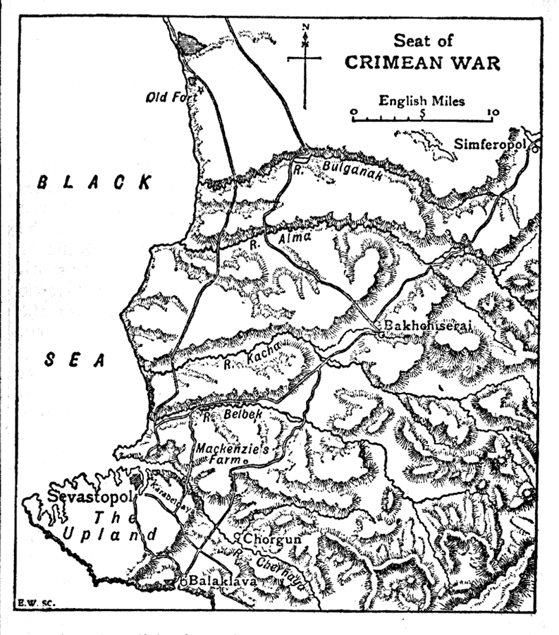
Description: This is a map of the southwest portion of the Crimean Peninsula, the Seat of the Crimean War between France, Great Britain, Russia and the Ottoman Empire. The map shows important cities and towns, roads, rivers, coastline, and terrain of the area. "When Turkey, after a period of irregular fighting, declared war on Russia in October 1853, Great Britain and France (subsequently assisted by Sardinia) intervened in the quarrel." — The Encyclopedia Britannica, 1910
Place Names: Ukraine, Crimea, �Crimean Peninsula, �Bulganak River, �Alma River, �Simferopol, �Bakhohiserai, �Belbek River, �Chorgun, �Chernaya River, �Balaklava, �Kacha River, �Sevastopol, �Black Se
ISO Topic Categories: boundaries,
inlandWaters,
oceans,
society
Keywords: Seat of Crimean War, physical, �political, �historical, �Crimean War, physical features, major political subdivisions, other military, boundaries,
inlandWaters,
oceans,
society, Unknown,1853–1856
Source: The Encyclopedia Britannica, The Encyclopedia Britannica 11th Edition Vol. 7 (New York, NY: The Encyclopedia Britannica Company, 1910) 450
Map Credit: Courtesy the private collection of Roy Winkelman |
|