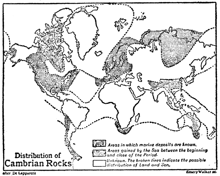
Description: This is a global map from 1910 showing the distribution of Cambrian Period rocks. This map shows areas in which marine deposits are known, areas gained by the Sea between the beginning and close of the Cambrian Period, and areas of unknown distribution of Land and Sea (possible distribution shown by a dashed line). "Cambrian System, in geology, the name now universally employed to designate the earliest group of Paleozoic rocks which possesses a connected suite of fossils. The strata of this system rest upon the Pre–Cambrian, and are succeeded by the Ordovician system." — The Encyclopedia Britannica, 1910
Place Names: A Complete Map of Globes and Multi-continent, Africa, �Asia, �Australia, �Europe, �North America, �South Americ
ISO Topic Categories: geoscientificInformation,
society
Keywords: Distribution of Cambrian Rocks, physical, �historical, �Cambrian, kGeology, physical features,
geological, geoscientificInformation,
society, Unknown,542 Ma. to 489 Ma.
Source: The Encyclopedia Britannica , The Encyclopedia Britannica 11th Edition Vol. 5 (New York, NY: The Encyclopedia Britannica Company, 1910) 87
Map Credit: Courtesy the private collection of Roy Winkelman |
|