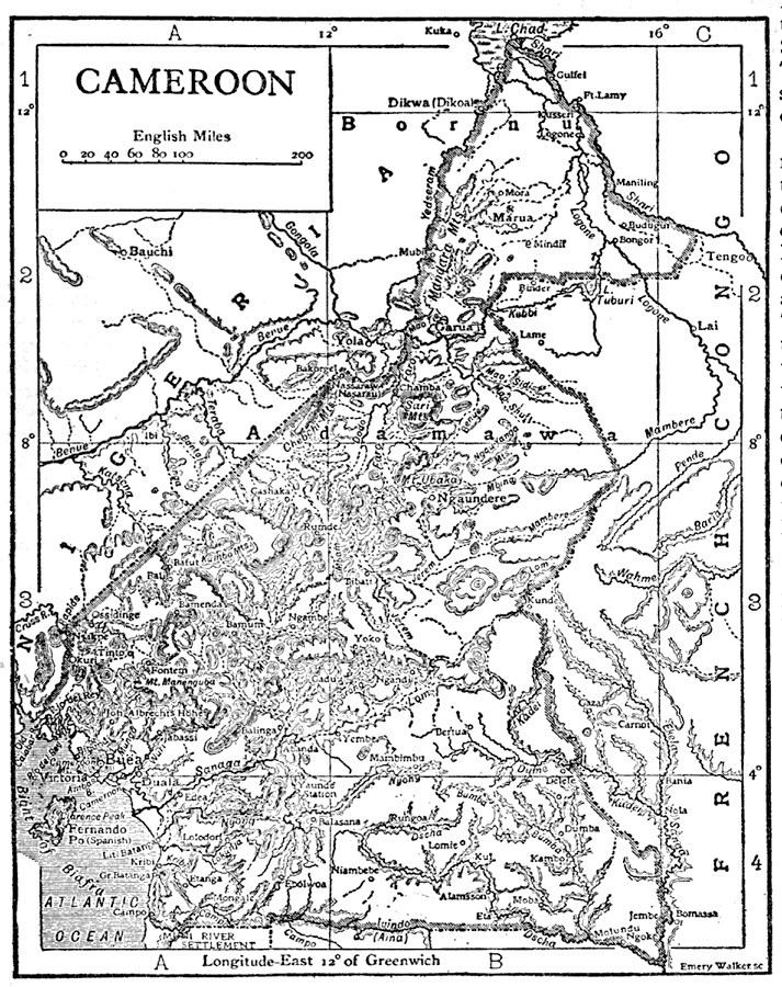
Description: This is a detailed map of Cameroon, Africa. It shows its capital Yaunde or Yaounde, other major cities and divisions, inland waters, oceans, and mountains. "Cameroon, a German protectorate in West Africa, bounded W. by the Atlantic, N.W. by British Nigeria, N. by Lake Chad, E. and S. by French Congo, save for a short distance on the south where it is conterminous with the Spanish Muni River settlement." — The Encyclopedia Britannica, 1910
Place Names: Cameroon, Ngaoundere, �Garoua, �Bamenda, �Maroua, �Ngaundere, �Garua, �Marua, �Kadei River, �Sanaga River, �Dja River, �Dscha River, �Bafut, �Kumbo Mountains, �Mandara Mountains, �Yoko, �Atlantic Ocean, �Yaounde, �Mount Cameroon, �Yaunde, �Lake Cha
ISO Topic Categories: boundaries,
inlandWaters,
oceans
Keywords: Cameroon, physical, boundaries,
inlandWaters,
oceans, Unknown,1910
Source: The Encyclopedia Britannica , The Encyclopedia Britannica 11th Edition Vol. 5 (New York, NY: The Encyclopedia Britannica Company, 1910) 110
Map Credit: Courtesy the private collection of Roy Winkelman |
|