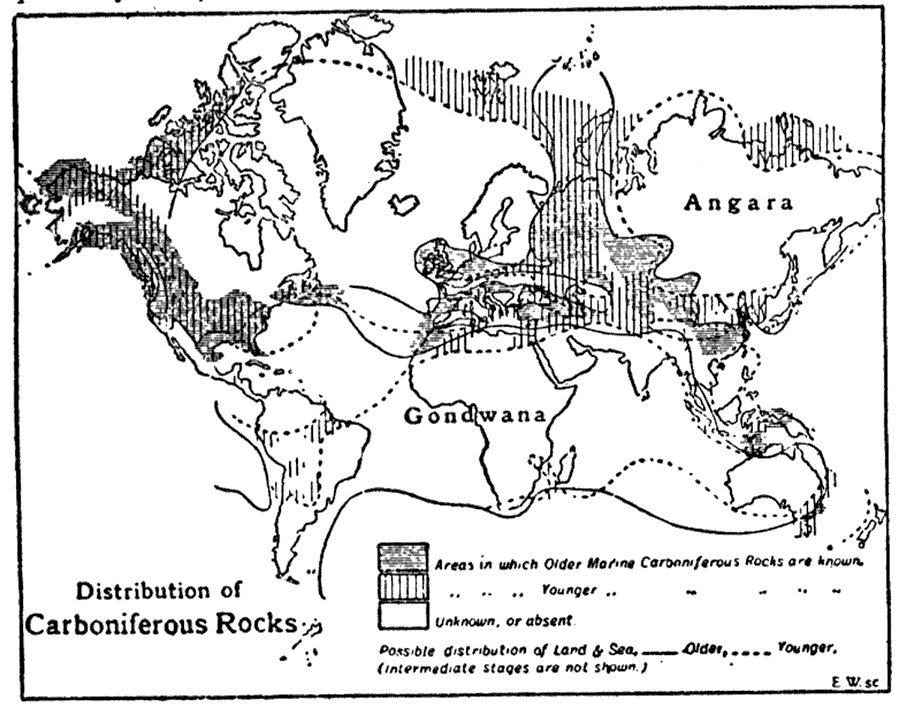
Description: This is a global map from 1910 showing the distribution of Carboniferous Period rocks. This map shows the land areas of Gondwana and Angara (Siberian craton), areas in which Older Marine Carboniferous Rocks are known, areas in which Younger Marine Carboniferous Rocks are known, areas where Carboniferous Rocks are absent or unknown, and the possible limits of land and sea distribution during the Older (solid lines) and Younger (dashed lines) periods. "Carboniferous System, in geology, the whole of the great series of stratified rocks and associated volcanic rocks which occur above the Devonian or Old Red Sandstone and below the Permian or Triassic systems, belonging to the Carboniferous period. The name was first applied by W. D. Conybeare in 1821 to the coal-bearing strata of England and Wales, including the related grits and limestones immediately beneath them." — The Encyclopedia Britannica, 1910
Place Names: A Complete Map of Globes and Multi-continent, Africa, �Asia, �Australia, �Europe, �North America, �South America, �Angara, �Gondwan
ISO Topic Categories: geoscientificInformation,
society
Keywords: Distribution of Carboniferous Rocks, physical, �historical, kGeology, physical features,
geological, geoscientificInformation,
society, Unknown,359 Ma. to 299 Ma.
Source: The Encyclopedia Britannica , The Encyclopedia Britannica 11th Edition Vol. 5 (New York, NY: The Encyclopedia Britannica Company, 1910) 310
Map Credit: Courtesy the private collection of Roy Winkelman |
|