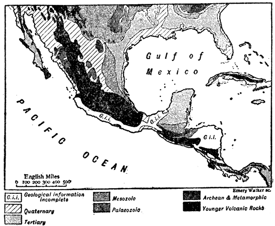
Description: A map from 1910 of Mexico and Central America, showing the distribution of rocks and indicating the geologic time period they come from. It shows Achaean and metamorphic rocks, younger volcanic rocks, Paleozoic rocks, Mesozoic rocks, Tertiary rocks, Quaternary rocks and places where geological information is incomplete. "The neck of land which unites the continents of North and South America is not, geologically, the direct continuation of either, but constitutes a third element which is wedged, as it were, between the other two. The folds in the earth's crust which form the Andes and the Western ranges of North America, are not continued along the connecting isthmus, where, on the contrary, the strata are folded from west to east, obliquely across the trend of the continent." — The Encyclopedia Britannica, 1910
Place Names: A Regional Map of North America, Honduras, �Nicaragua, �Costa Rica, �Panama, �Guatemala, �Belize, �El Salvado
ISO Topic Categories: oceans,
society,
geoscientificInformation
Keywords: Geology of Mexico and Central America, physical, kCentralAmerica, kGeology, physical features,
geological, oceans,
society,
geoscientificInformation, Unknown,1910
Source: The Encyclopedia Britannica , The Encyclopedia Britannica 11th Edition Vol. 5 (New York, NY: The Encyclopedia Britannica Company, 1910) 675
Map Credit: Courtesy the private collection of Roy Winkelman |
|