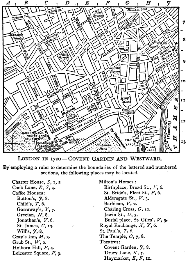
Description: A detailed map of London Circa1720 showing major roads, the River Thames parks, government buildings and locations pertaining to the times of Joseph Addison (1672 – 1719) west of Covent Gardens. "By employing a ruler to determine the boundaries of the lettered and numbered sections, the following places may be located. Coffee Houses: (Button's, J,8) (St. James, C,13) (Will's, J,8) (Leicester Square, F,9) Milton's Homes: (Charing Cross, G,12) Theatres: (Covent Garden, J,8) (Haymarket, E,F,11)" —Walker, 1908
Place Names: United Kingdom, London, �Covent Garden, �Thames River,
ISO Topic Categories: location,
inlandWaters,
transportation
Keywords: London - Covent Garden and Westward, physical, �transportation, physical features, roads, location,
inlandWaters,
transportation, Unknown,1720
Source: Albert Perry Walker, Macaulay's Essay on Addison (Boston, MA: D. C. Heath & Company, 1908) 124
Map Credit: Courtesy the private collection of P. Green |
|