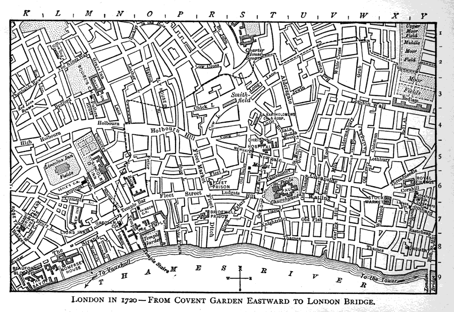
Description: A detailed map of London Circa1720 showing major roads, the River Thames, parks, government buildings and locations pertaining to the times of Joseph Addison (1672 – 1719) east of Covent Gardens to London Bridge. "By employing a ruler to determine the boundaries of the lettered and numbered sections, the following places may be located. (Carter House, S, 1, 2) (Cock Lane, R, S, 4) Coffee Houses: (Child's, T, 6) (Garraway's, Y, 7) (Grecian, N, 8) (Jonathan's, Y, 6) (Gray's Inn, M 3) (Grub St., W, 2) (Holborn Hill, P, 4) Milton's Homes: (Birthplace, Bread St., V, 6) (St. Bride's, Fleet St., P, 6) (Aldersgate St., V, 3) (Barbican, V, 2) (Jewin St, U, 3) (Burial place, St. Gile's, V, 3) (Royal Exchange, X, Y, 6) (St. Paul's, T, 6) (The Temple, O, 7, 8) Theatres: (Drury Lane, K, 7)" —Walker, 1908
Place Names: United Kingdom, London, �Covent Garden, �Thames River,
ISO Topic Categories: location,
inlandWaters,
transportation
Keywords: London - Covent Garden and Eastward to London Bridge, physical, �transportation, kwordphysical features, roads, location,
inlandWaters,
transportation, Unknown,1720
Source: Albert Perry Walker, Macaulay's Essay on Addison (Boston, MA: D. C. Heath & Company, 1908) 125
Map Credit: Courtesy the private collection of P. Green |
|
