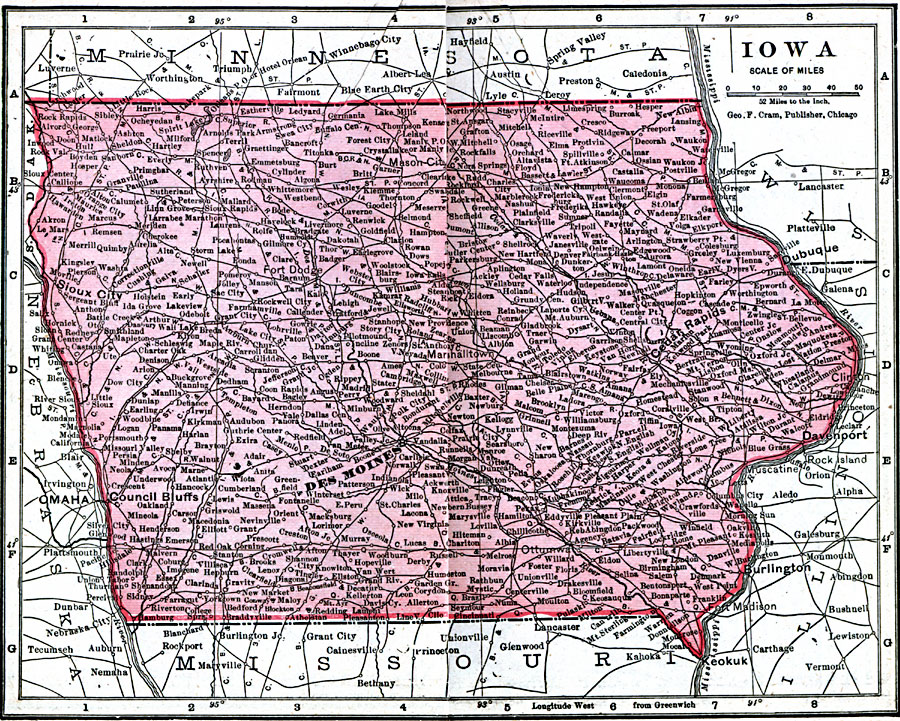
Description: A map from 1906 of Iowa showing the State capital of Des Moines, major cities and towns, railroads, and rivers, including the border rivers of the Mississippi and Missouri.
Place Names: Iowa, Cedar Falls, �Clinton, �Creston, �Des Moines, �Dubuque, �Hamburg, �Iowa City, �Mason, �Sioux City, �Waterlo
ISO Topic Categories: boundaries,
inlandWaters,
location,
oceans
Keywords: Iowa, physical, �political, �borders, �boundaries, �physical features, country borders, boundaries,
inlandWaters,
location,
oceans, Unknown, 1906
Source: George F. Cram , Cram's Quick Reference Atlas and Gazetteer of the World (Chicago , IL: George F. Cram Series of Atlases, 1906) 40
Map Credit: Courtesy the private collection of Roy Winkelman |
|