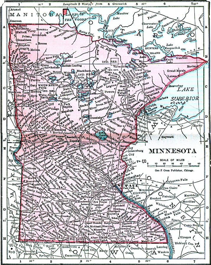
Description: A map from 1906 of Minnesota showing the capital of St. Paul, major cities and towns, the Red Lake Indian Lands, railroads, lakes, and rivers, including the headwaters of the Mississippi River.
Place Names: Minnesota, Anoka, �Faribault, �Mankato, �Minneapolis, �Red Wing, �Rochester, �St. Cloud, �St. Paul, �Winona, �Worthingto
ISO Topic Categories: boundaries,
inlandWaters,
location,
oceans
Keywords: Minnesota, physical, �political, �borders, �boundaries, kNativeAmerican, physical features, country borders, boundaries,
inlandWaters,
location,
oceans, Unknown, 1906
Source: George F. Cram , Cram's Quick Reference Atlas and Gazetteer of the World (Chicago , IL: George F. Cram Series of Atlases, 1906) 41
Map Credit: Courtesy the private collection of Roy Winkelman |
|