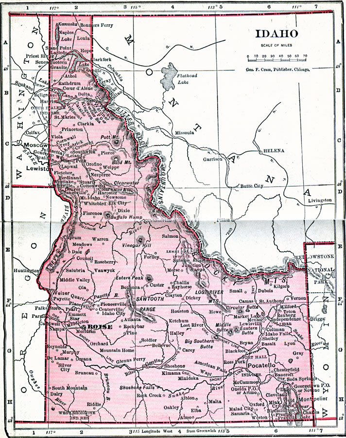
Description: A map from 1906 of Idaho showing the capital city Boise, towns, railroads, reservation boundaries, the boundary of Yellowstone National Park, mountain systems, lakes, and rivers.
Place Names: Idaho, Boise City, �Caldwell, �Ft. Hall, �Lewiston, �Moscow, �Nampa, �Pendid Oreille, �Pocatello, �Silver City, �Taylors Bridg
ISO Topic Categories: boundaries,
inlandWaters,
location,
oceans
Keywords: Idaho, physical, �political, �borders, �boundaries, kNativeAmerican, physical features, country borders, boundaries,
inlandWaters,
location,
oceans, Unknown, 1906
Source: George F. Cram , Cram's Quick Reference Atlas and Gazetteer of the World (Chicago , IL: George F. Cram Series of Atlases, 1906) 52
Map Credit: Courtesy the private collection of Roy Winkelman |
|