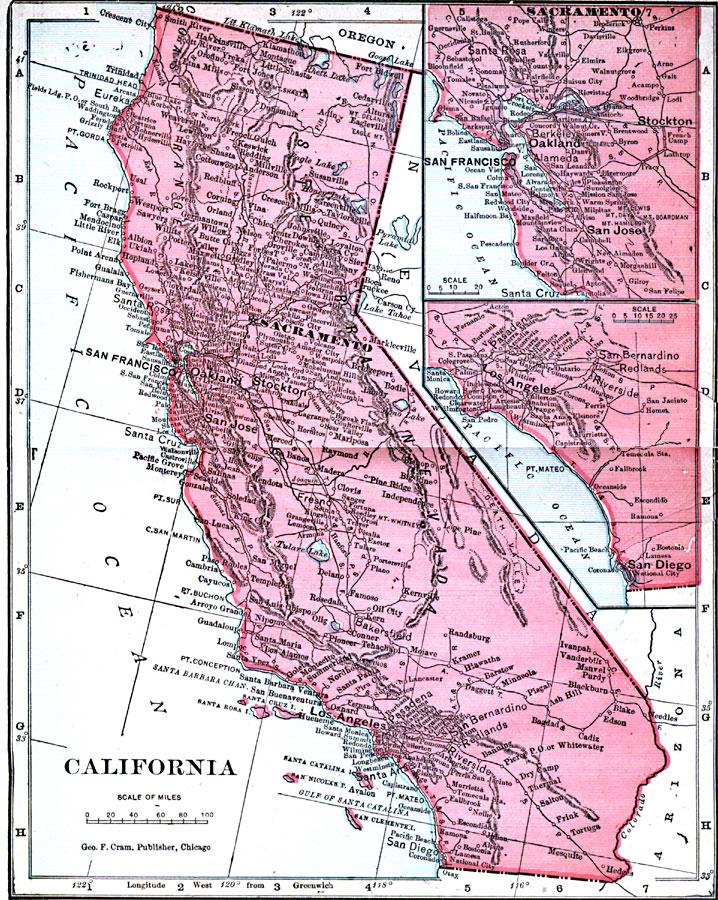
Description: A map of California from 1906 showing the State capital of Sacramento, major cities and towns, railroads, mountain systems, lakes, rivers, and coastal features. Two inset maps detail the San Francisco Bay area and the vicinity of Los Angles to San Diego.
Place Names: California, Humboldt, �Los Angeles, �Oakland, �Redding, �Sacramento, �San Diego, �San Francisco, �Santa Barbara, �Stockton, �Yrek
ISO Topic Categories: boundaries,
inlandWaters,
location,
oceans
Keywords: California, physical, �political, �borders, �boundaries, �physical features, country borders, boundaries,
inlandWaters,
location,
oceans, Unknown, 1906
Source: George F. Cram , Cram's Quick Reference Atlas and Gazetteer of the World (Chicago , IL: George F. Cram Series of Atlases, 1906) 56
Map Credit: Courtesy the private collection of Roy Winkelman |
|
