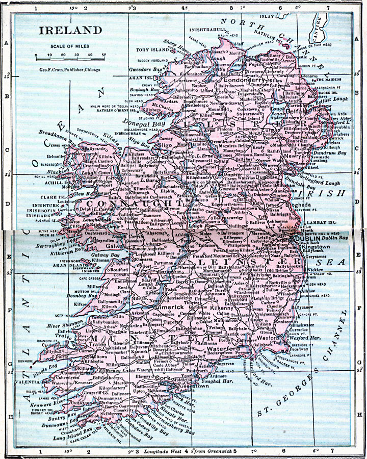
Description: Map of Ireland in 1906, showing major cities, towns, and ports, railways, rivers, and coastal features. This map shows the political divisions of Ulster, Connaught, Leinster, and Munster, and the Irish Sea, North Channel, St. George's Channel, Dingle Bay, Cork Harbor, Dublin Bay, Dunalk Bay, and Donegal Bay.
Place Names: Ireland, Ireland, �Cork, �Dublin, �Foynes, �Galway, �Killarney, �Limerick, �Monaghan, �New Ross, �Shannon, �Slig
ISO Topic Categories: boundaries,
inlandWaters,
location,
oceans
Keywords: Ireland, physical, �political, �borders, �boundaries, �physical features, country borders, boundaries,
inlandWaters,
location,
oceans, Unknown, 1906
Source: George F. Cram , Cram's Quick Reference Atlas and Gazetteer of the World (Chicago , Illinois : George F. Cram Series of Atlases, 1906) 76
Map Credit: Courtesy the private collection of Roy Winkelman |
|