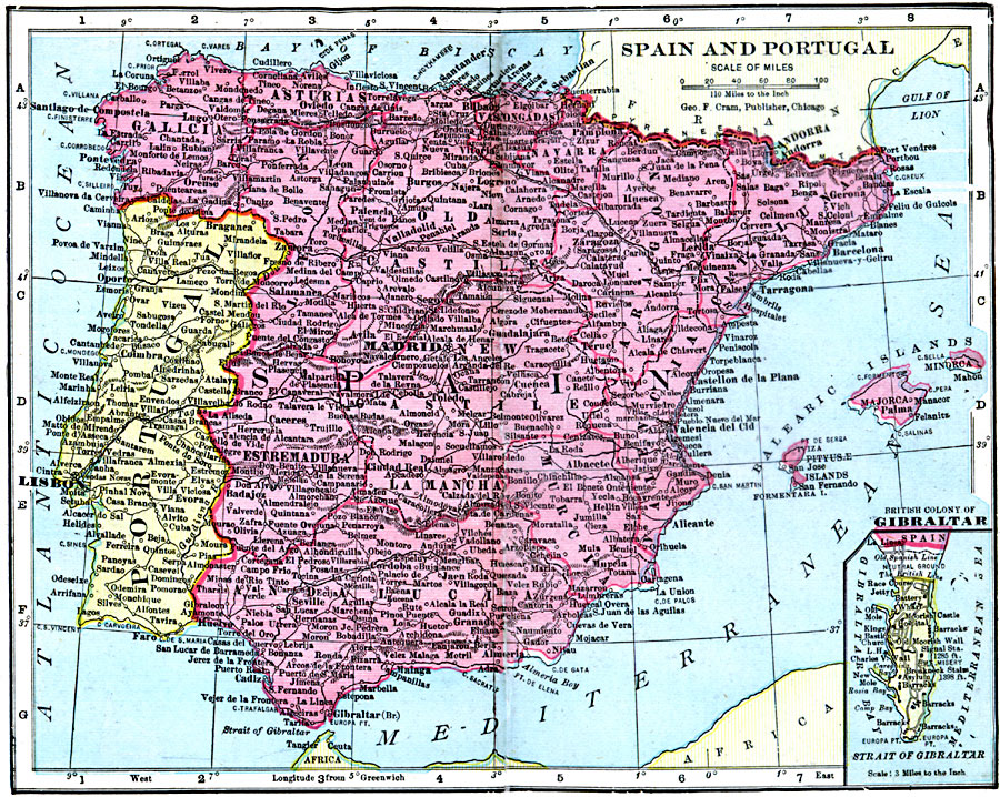
Description: A map from 1906 of Spain and Portugal showing country borders, provinces, major cities and towns, railways, rivers, and mountain systems, and includes an inset map detailing the British colony of Gibraltar.
Place Names: Iberian Peninsula, Lisbon, �Madrid, �Portugal, �Spai
ISO Topic Categories: boundaries,
inlandWaters,
location,
oceans
Keywords: Spain and Portugal, physical, �political, �borders, �boundaries, �physical features, country borders, boundaries,
inlandWaters,
location,
oceans, Unknown, 1906
Source: George F. Cram , Cram's Quick Reference Atlas and Gazetteer of the World (Chicago , IL: George F. Cram Series of Atlases, 1906) 79
Map Credit: Courtesy the private collection of Roy Winkelman |
|