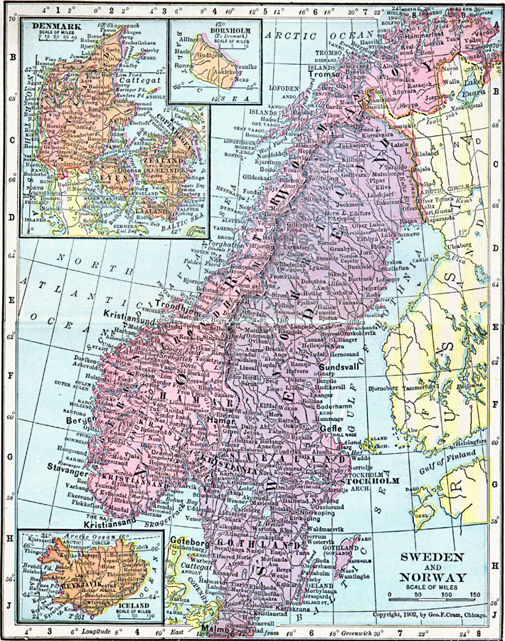
Description: A map from 1906 of Sweden and Norway showing the national boundaries, including the boundary with Russia (Finland) along the Tana Elf, Anar, and Tornea rivers, major cities, ports, and towns, rivers, islands, costal features, and mountain systems. The map also has inset maps of Denmark, Iceland, and the island of Bornholm (to Denmark).
Place Names: Scandinavia, Bornholm, �Denmark, �Iceland, �Norway, �Swede
ISO Topic Categories: boundaries,
inlandWaters,
location,
oceans
Keywords: Sweden and Norway, physical, �political, �borders, �boundaries, �physical features, country borders, boundaries,
inlandWaters,
location,
oceans, Unknown, 1906
Source: George F. Cram , Cram's Quick Reference Atlas and Gazetteer of the World (Chicago , IL: George F. Cram Series of Atlases, 1906) 83
Map Credit: Courtesy the private collection of Roy Winkelman |
|