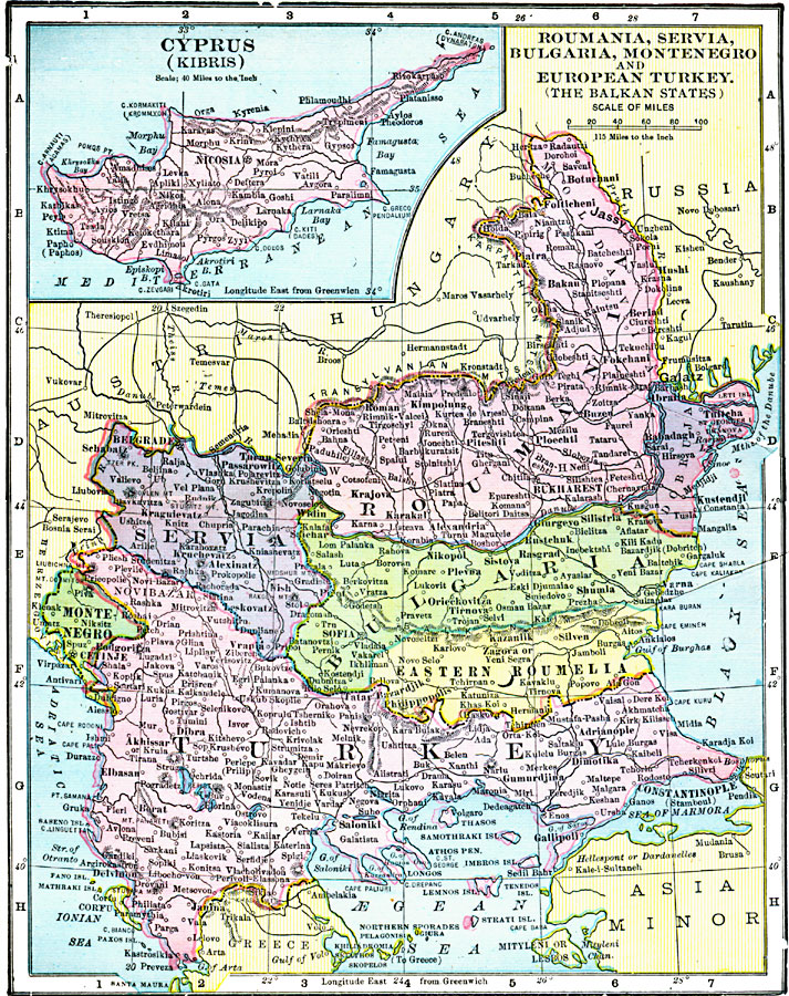
Description: A map from 1906 of Roumania, Servia, Bulgaria, Montenegro and European Turkey (the Balkan States) showing major cities, railways, rivers, and mountain systems of the region. An inset map shows the island of Cyprus (Kibris).
Place Names: Southeastern Europe, Balkan, �Bulgaria, �Cyprus, �Montenegro, �Romania, �Serbia, �Servia, �Turke
ISO Topic Categories: boundaries,
inlandWaters,
location,
oceans
Keywords: Roumania, Servia, Bulgaria, Montenegro and European Turkey (the Balkan States), physical, �political, �borders, �boundaries, kEuropeanOttomanEmpire, physical features, country borders, boundaries,
inlandWaters,
location,
oceans, Unknown, 1906
Source: George F. Cram , Cram's Quick Reference Atlas and Gazetteer of the World (Chicago , IL: George F. Cram Series of Atlases, 1906) 86
Map Credit: Courtesy the private collection of Roy Winkelman |
|