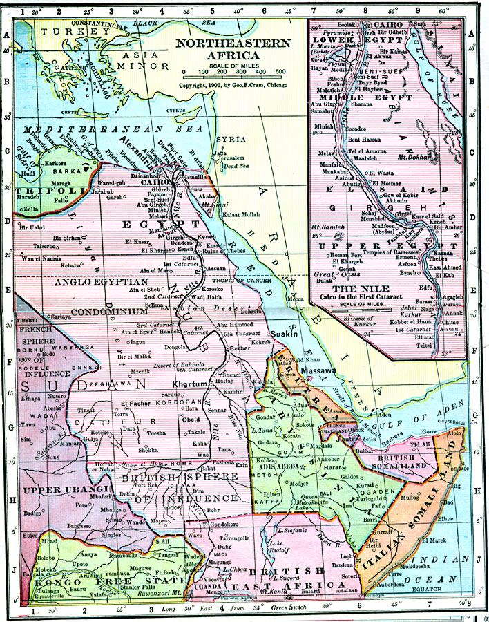
Description: Map of Northeastern Africa in 1906 showing the region and territorial boundaries after the Berlin Conference of 1885. The map shows the European land claims of English East Africa, Kongo Free State, British Somali Land and Italian Somali Land, the European interests of the Anglo Egyptian Condominium, French and British spheres of influence, and the African States of Erithea and Abyssinia. An inset map details the area between Cairo and the First Cataract on the Nile River.
Place Names: A Regional Map of Africa, Abyssinia, �Egypt, �Tripoli, �Upper Ubangi, �Sudan, �Somalia, �Syri
ISO Topic Categories: boundaries,
inlandWaters,
location,
oceans
Keywords: Northeastern Africa, physical, �political, �borders, �boundaries, kBerlinConference, physical features, country borders, boundaries,
inlandWaters,
location,
oceans, Unknown, 1906
Source: George F. Cram , Cram's Quick Reference Atlas and Gazetteer of the World (Chicago , Illinois : George F. Cram Series of Atlases, 1906) 89
Map Credit: Courtesy the private collection of Roy Winkelman |
|