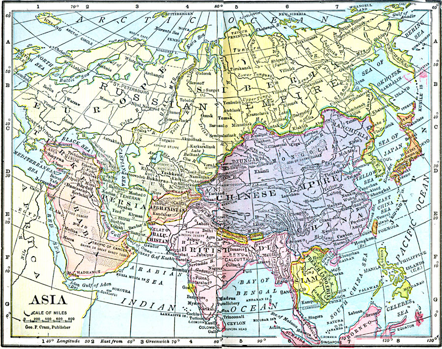
Description: A map of Asia from 1906 showing country boundaries at the time, major cities, railroads, rivers, lakes, terrain, and coastal features. The map indicates foreign possessions in the region with British India (which included Myanmar or Burma), French Indochina, and shows the Philippines as a possession of the United States.
Place Names: A Complete Map of Asia, China, �India, �Indonesia, �Japan, �Kazakhstan, �Mongolia, �Pakistan, �Phillipines, �Russia, �Thailand,�French Indochina, �Baluchistan, �Persia, �Arabia
ISO Topic Categories: boundaries,
inlandWaters,
location,
oceans
Keywords: Asia, physical, �political, �borders, �boundaries, �physical features, country borders, boundaries,
inlandWaters,
location,
oceans, Unknown, 1906
Source: George F. Cram , Cram's Quick Reference Atlas and Gazetteer of the World (Chicago , IL: George F. Cram Series of Atlases, 1906) 92
Map Credit: Courtesy the private collection of Roy Winkelman |
|