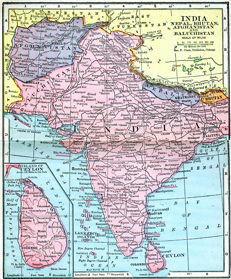
Description: A map from 1906 showing the political boundaries of India, Nepal, Bhutan, Afghanistan, and Baluchistan at the time. The map shows capitals and major cities, ports, railroads, mountain systems, rivers, and coastal features of the region. French, Portuguese, and Oman possessions are shown with underlined names. An inset map details the island of Ceylon (Sri Lanka).
Place Names: Southern Asia, Afghanistan, �Baluchistan, �Bhutan, �Ceylon, �India, �Nepa
ISO Topic Categories: boundaries,
inlandWaters,
location,
oceans
Keywords: India, Nepal, Bhutan, Afghanistan, and Baluchistan, physical, �political, �borders, �boundaries, �physical features, country borders, boundaries,
inlandWaters,
location,
oceans, Unknown, 1906
Source: George F. Cram , Cram's Quick Reference Atlas and Gazetteer of the World (Chicago , IL: George F. Cram Series of Atlases, 1906) 94
Map Credit: Courtesy the private collection of Roy Winkelman |
|