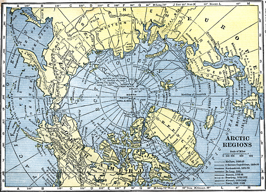
Description: A map of the North Polar Region from 1920 showing the routes of Arctic expeditions, from the sinking of the USS Jeanette in 1881 to the date that Commander Peary first reached the North Pole (April 6, 1909). The map shows the routes George De Long (1881), Fridtjof Nansen (1893–1896), Duke of the Abruzzi (1899–1900), and the Peary expeditions of 1900, 1902, 1906, and 1909.
Place Names: Arctic Region, Alaska, �Canada, �Greenland, �Iceland, �Russi
ISO Topic Categories: boundaries,
inlandWaters,
location,
oceans
Keywords: The Arctic Regions, physical, �political, �transportation, physical features, country borders, water routes, boundaries,
inlandWaters,
location,
oceans, Unknown, 1850–1909
Source: John C. Winston, Winston's New and Complete Atlas of the World (New York, NY: The John C. Winston Company, 1920) 2
Map Credit: Courtesy the private collection of Roy Winkelman |
|