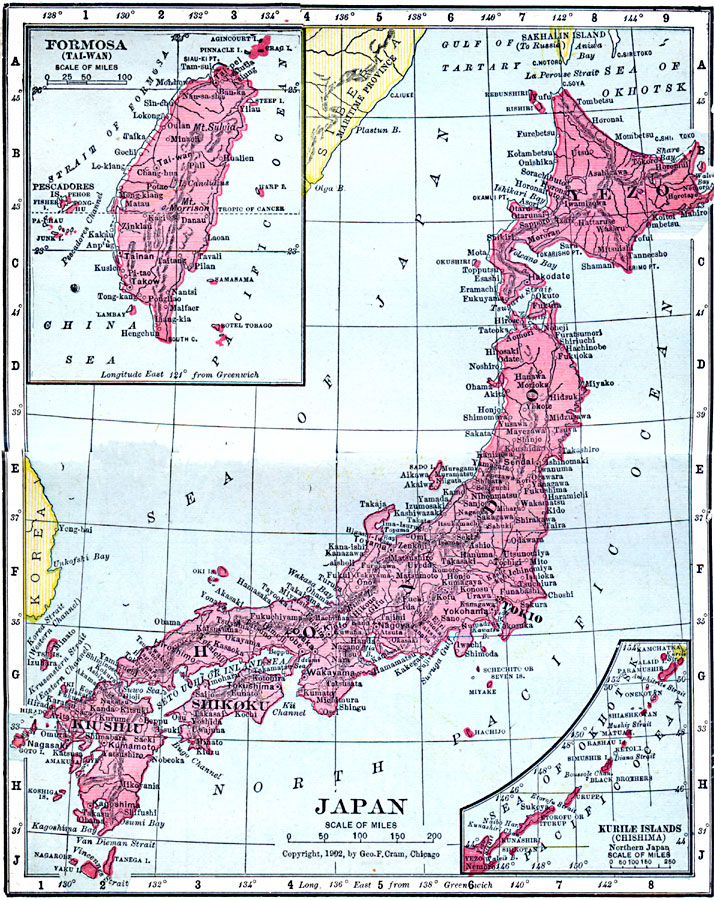
Description: A map from 1906 of the Japanese Islands, including Yezo (Hokkaido), Hondo (Honshu), Shikoku, and Kiushiu (Kyushu). Inset maps detail the Japanese possession of Formosa (Taiwan) and the Kurile or Chishima Islands of northern Japan. The map shows the southern tip of Sakhalin Island as a possession of Russia, even though, at the time of this map, Japan had won the portion of the island south of 50° North latitude as a concession of the Russo–Japanese war of 1904–1905. The Ryukyu Islands to the south toward Taiwan are not shown on this map. Major cities, railways, rivers, islands, and coastal features are shown.
Place Names: Japan, Akita, �Fukuoka, �Hiroshima, �Kobe, �Nagoya, �Osaka, �Sapporo, �Sendai, �Tokyo, �Yokoham
ISO Topic Categories: boundaries,
inlandWaters,
location,
oceans
Keywords: Japan, physical, �political, �borders, �boundaries, �physical features, country borders, boundaries,
inlandWaters,
location,
oceans, Unknown, 1906
Source: George F. Cram , Cram's Quick Reference Atlas and Gazetteer of the World (Chicago , IL: George F. Cram Series of Atlases, 1906) 97
Map Credit: Courtesy the private collection of Roy Winkelman |
|