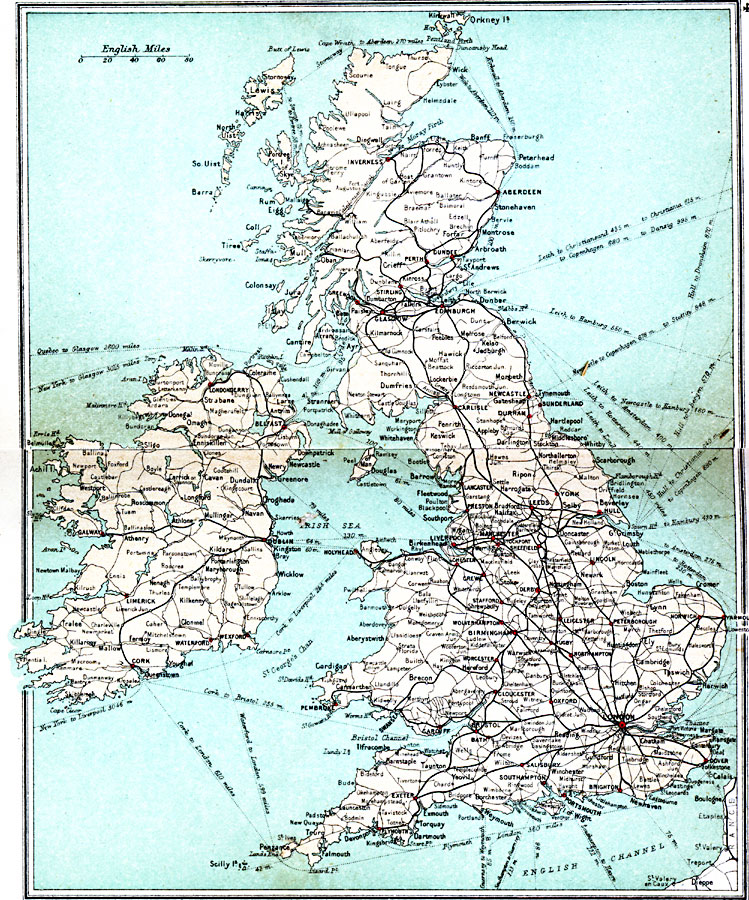
Description: A map of the British Isles in 1908, showing primary and secondary railway routes, cities with main stations marked in red, and steamship routes with distances in miles between ports.
Place Names: United Kingdom, Bristol, �Dundee, �Edinborough, �Falmouth, �Glasgow, �London, �Londonderry, �Manchester, �Newcastle, �Plymout
ISO Topic Categories: inlandWaters,
location,
oceans,
transportation
Keywords: Railways of the British Isles, railroads, �transportation, railroads, inlandWaters,
location,
oceans,
transportation, Unknown, 1908
Source: J.G. Bartholomew, F.R.G.S., The Handy Touring Atlas of the British Isles Specially Prepared for Cyclists, Motorists, and Travellers (London, United Kingdom : George Newnes, Limited, 1908) 4-5
Map Credit: Courtesy the private collection of Roy Winkelman |
|