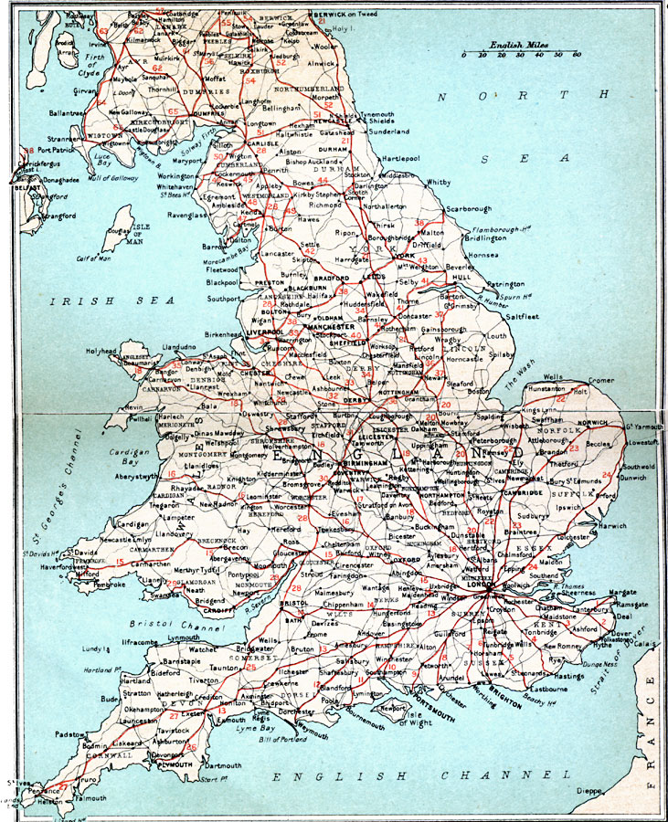
Description: A map of England, Wales, and southern Scotland in 1908, showing the "High Roads" with route numbers, and the major secondary roads.
Place Names: United Kingdom, Bristol, �Dundee, �Edinborough, �Falmouth, �Glasgow, �London, �Londonderry, �Manchester, �Newcastle, �Plymout
ISO Topic Categories: inlandWaters,
location,
oceans,
transportation
Keywords: High Roads of England and Wales, roads, �transportation, roads, inlandWaters,
location,
oceans,
transportation, Unknown, 1908
Source: J.G. Bartholomew, F.R.G.S., The Handy Touring Atlas of the British Isles Specially Prepared for Cyclists, Motorists, and Travellers (London, United Kingdom : George Newnes, Limited, 1908) 6-7
Map Credit: Courtesy the private collection of Roy Winkelman |
|