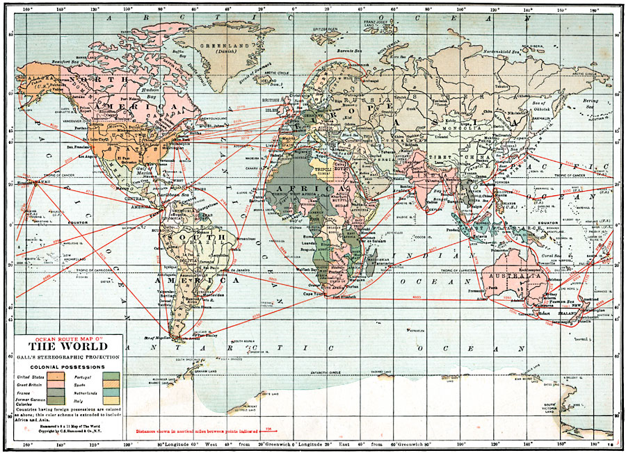
Description: An ocean route map of the world from 1920 in Gall's Stereographic Projection, showing primary steamship routes with distances between ports given in nautical miles. This map is color–coded to show the possessions of the United States, Great Britain, France, Portugal, Spain, Netherlands, Italy, and the former German colonies at the time. The map also shows the extent of Antarctic exploration of the time.
Place Names: A Complete Map of Globes and Multi-continent, Africa, �Antarctica, �Asia, �Australia, �Europe, �South America, �North Americ
ISO Topic Categories: boundaries,
inlandWaters,
location,
oceans,
transportation
Keywords: Ocean Route Map of the World with Colonial Possessions, physical, �political, �transportation, kMapProjection, physical features, country borders, water routes, boundaries,
inlandWaters,
location,
oceans,
transportation, Stereographic, 1920
Source: , Leslie's New World Atlas (New York City, New York: Leslie-Judge Company, 1920) 9
Map Credit: Courtesy the private collection of Roy Winkelman |
|