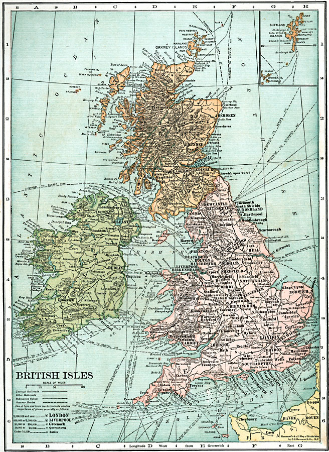
Description: A map of the British Isles in 1920, showing railroads, submarine cables, and steamer routes (with distance between ports noted). The map shows major cities and ports, rivers, and terrain. An inset map shows the Shetland and Orkney Islands.
Place Names: United Kingdom, Ireland, �Scotland, �England, �London, �Greenwich, �Dublin, �Limerick, �Waterford, �Belfast, �Londonderry, �Glasgow, �Aberdeen, �Dundee, �Perth, �Edinburgh, �Brighton, �Exeter, �Plymouth, �Cardiff, �Sunderlan
ISO Topic Categories: boundaries,
utilitiesCommunication,
transportation,
oceans,
location,
inlandWaters
Keywords: British Isles, physical, �political, �transportation, �british isles post wwi, physical features, country borders,
major political subdivisions, roads,
railroads,
water routes, boundaries,
utilitiesCommunication,
transportation,
oceans,
location,
inlandWaters, Unknown, 1920
Source: , Leslie's New World Atlas (New York City, New York: Leslie-Judge Company, 1920) 13
Map Credit: Courtesy the private collection of Roy Winkelman |
|
