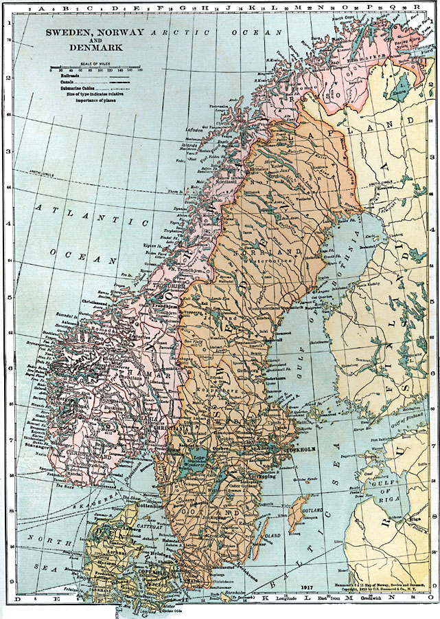
Description: A map of Sweden, Norway and Denmark in 1920, showing major cities, ports, and towns, railroads, canals, and submarine cables. This map shows the Danish border with Germany south of Jutland, with Schleswig to Germany. On this map, the Norwegian capital of Oslo is labeled with the former name "Christiania."
Place Names: Scandinavia, Norway, �Sweden, �Finland, �Lapland, �Russia, �Gotland, �Copenhagen, �Denmark, �Christiana, �Stockholm, �Norrkopin
ISO Topic Categories: boundaries,
inlandWaters,
location,
oceans,
transportation,
utilitiesCommunication
Keywords: Sweden, Norway, and Denmark, physical, �political, �transportation, country borders,
major political subdivisions, railroads,
water routes, boundaries,
inlandWaters,
location,
oceans,
transportation,
utilitiesCommunication, Unknown, 1920
Source: , Leslie's New World Atlas (New York City, NY: Leslie-Judge Company, 1920) 17
Map Credit: Courtesy the private collection of Roy Winkelman |
|