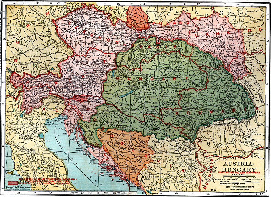
Description: A map of Austria–Hungary in 1920, showing railroads, canals, and submarine telegraph lines. This map shows the partition of the Austro–Hungarian territories after WWI, showing the new boundaries established by the Treaty of Saint Germaine (1919) and the Treaty of Trianon (1920). The map also shows conjectural boundaries drawn along ethnographical lines with shaded areas showing sovereignty to be decided by plebiscite, and the boundary along the Adriatic Sea as established by the Treaty of London. The new territories shown are Czechoslovakia, Roumania, Hungary, Austria, and Jugoslavia, with territorial annexations by Poland, Ukraine, Bulgaria, and Italy.
Place Names: Austria-Hungary, Belgrade, �Bukharest, �Czernowitz, �Horodenka, �Krakow, �Dresden, �Chemnitz, �Pilsen, �Klattau, �Nuremberg, �Munich, �Linz, �Vienna, �Gratz, �Pressburg, �Keskemet, �Grosswardein, �Debreczin, �Hodmezo, �Vasarhely, �Szegedin, �Maria, �Theresiopel, �Temes
ISO Topic Categories: boundaries,
inlandWaters,
location,
oceans,
transportation,
utilitiesCommunication
Keywords: Austria-Hungary, physical, �political, �transportation, �post world war one, post wwi, kWWI, physical features, country borders,
major political subdivisions, railroads,
water routes, boundaries,
inlandWaters,
location,
oceans,
transportation,
utilitiesCommunication, Unknown, 1920
Source: , Leslie's New World Atlas (New York City, New York: Leslie-Judge Company, 1920) 19
Map Credit: Courtesy the private collection of Roy Winkelman |
|