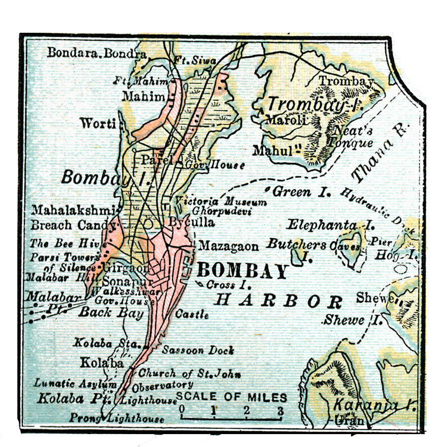
Description: A map from 1920 of Bombay (Mumbai) and Bombay Harbor at the time. The map shows the city at the southern point of Bombay Island, which at the time was one of the archipelago of Bombay Harbor (Seven Islands of Mumbai), separated from Salsette and Trombay islands. At the time of this map, the islands of Kolaba, Bombay, Mazagaon, Worli, Parel, and Mahim had been joined together to form one island. The map also shows the islands of Elephanta (Gharapuri), Butcher, and Karanja. Major thoroughfares, railways, docks, government buildings, and historic sites are shown.
Place Names: India , Bombay, �Trombay Island, �Bombay Island, �Kolaba, �Byculla, �Mazagaon, �Worti, �Mahi
ISO Topic Categories: inlandWaters,
location,
oceans,
transportation
Keywords: Bombay, physical, �political, �transportation, physical features, inlandWaters,
location,
oceans,
transportation, Unknown, 1920
Source: , Leslie's New World Atlas (New York City, NY: Leslie-Judge Company, 1920) 25
Map Credit: Courtesy the private collection of Roy Winkelman |
|