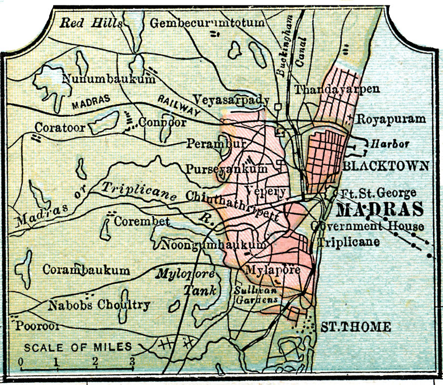
Description: A map from 1920 of the environs around the city of Madras, India. The map shows the urban area of the city at the time, railroads, the Buckingham Canal, the city harbor, Fort St. George, neighboring cities and towns, lakes, and rivers of the area.
Place Names: India , Madras, �Blacktown, �St. Thome, �Mylapore, �Perambur, �Veyasarpady, �Coratoo
ISO Topic Categories: inlandWaters,
location,
oceans,
transportation
Keywords: Madras, physical, �transportation, physical features, inlandWaters,
location,
oceans,
transportation, Unknown, 1920
Source: , Leslie's New World Atlas (New York City, NY: Leslie-Judge Company, 1920) 25
Map Credit: Courtesy the private collection of Roy Winkelman |
|