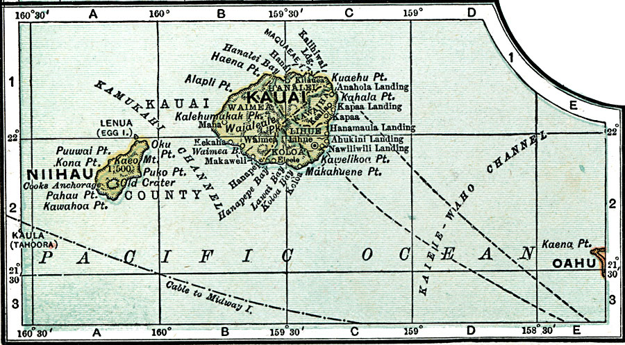
Description: A map from 1920 of the northwest Hawaiian Islands of Kauai and Niihau, showing towns and ports, submarine cable routes, and the terrain and coastal features of the islands.
Place Names: Hawaii, Kauai, �Niihau, �Pahau Point, �Lihue, �Koloa, �Makaweli, �Hanapepe, �Mana, �Kilauea, �Kapa
ISO Topic Categories: oceans,
location,
utilitiesCommunication
Keywords: Northwest Hawaiian Islands, physical, physical features, oceans,
location,
utilitiesCommunication, Unknown, 1920
Source: , Leslie's New World Atlas (New York City, NY: Leslie-Judge Company, 1920) 28
Map Credit: Courtesy the private collection of Roy Winkelman |
|