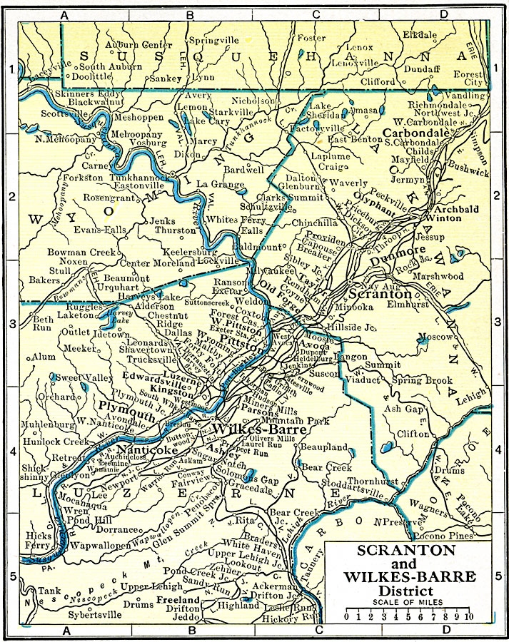
Description: A map from 1920 of the vicinity of Scranton and Wilkes-Barre district showing county lines, principal cities and towns, railroads, lakes, and rivers.
Place Names: Pennsylvania, Scranton, �Wilkes-barre, �Plymout
ISO Topic Categories: boundaries,
transportation,
location,
inlandWaters
Keywords: Scranton and Wilkes-Barre, physical, �political, �transportation, physical features, county borders,
local jurisdictions, roads,
railroads, boundaries,
transportation,
location,
inlandWaters, Unknown, 1920
Source: John C. Winston, Winston's New and Complete Atlas of the World (New York, NY: The John C. Winston Company, 1920) 107
Map Credit: Courtesy the private collection of Roy Winkelman |
|