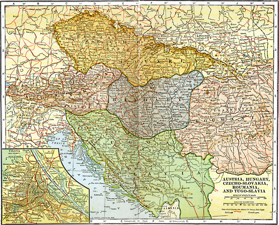
Description: A map from 1920 of Southeastern Europe, showing Austria, Czechoslovokia, Hungary, Romania, and Yugoslavia, showing country boundaries and capitals, principal cities and towns, railroads, mountain systems, lakes, rivers, islands, and coastal features.
Place Names: Western and Central Europe, Czecho-Slovakia, �Austria, �Hungary, �Romani
ISO Topic Categories: boundaries,
inlandWaters,
location,
oceans,
transportation
Keywords: Southeastern Europe, political, �physical, �transportation, physical features, country borders, railroads, boundaries,
inlandWaters,
location,
oceans,
transportation, Unknown, 1920
Source: John C. Winston, Winston's New and Complete Atlas of the World (New York, NY: The John C. Winston Company, 1920) 166
Map Credit: Courtesy the private collection of Roy Winkelman |
|