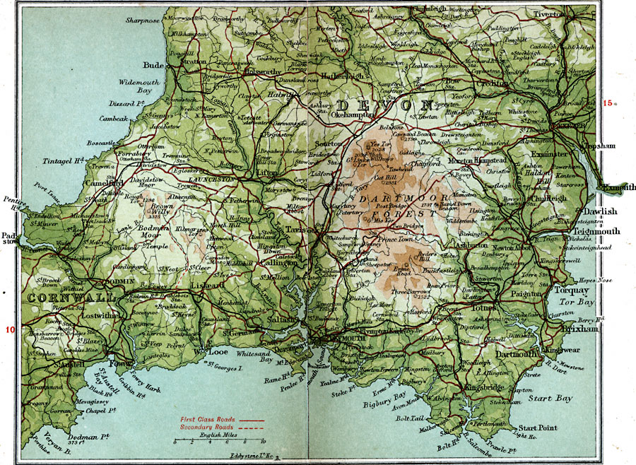
Description: A detailed travel map of southwestern England from 1908, showing the southern portion of Devon County and western portion of Cornwall. The map shows first class and secondary roads, railways, cities, towns, coastal and terrain features of the area. This map uses contour–coloring to show terrain, with elevations shown in feet. Cities and towns on this map include Tiverton, Exeter, Teignmouth, Dartmouth, Plymouth, Launceston, Bude, Fowey, and St. Austell. Rivers and coastal features include River Exe, River Torridge, River Dart, Tintagel Head, Pentire Head, Start Point, and the Dartmoor Forest.
Place Names: United Kingdom, Cornwall, �Dartmoor Forest, �Dartmouth, �Devon, �Plymouth, �Tavistoc
ISO Topic Categories: inlandWaters,
location,
oceans,
transportation
Keywords: Devon South, roads, �transportation, roads, inlandWaters,
location,
oceans,
transportation, Unknown, 1908
Source: J.G. Bartholomew, F.R.G.S., The Handy Touring Atlas of the British Isles Specially Prepared for Cyclists, Motorists, and Travellers (London, United Kingdom : George Newnes, Limited, 1908) 12-13
Map Credit: Courtesy the private collection of Roy Winkelman |
|