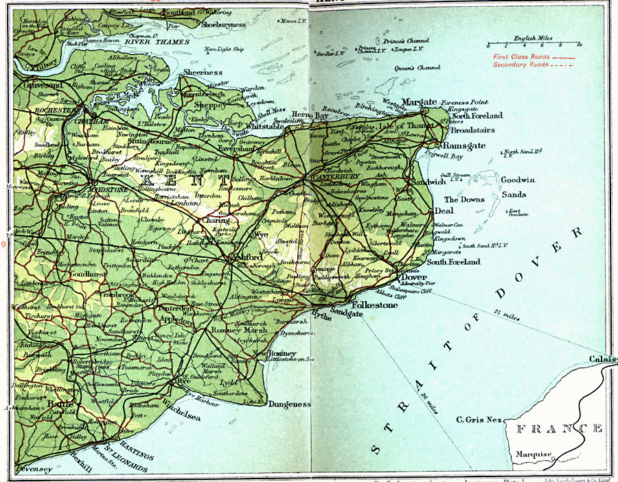
Description: A detailed travel map of southeastern England from 1908, showing portions of Kent County. The map shows first class and secondary roads, railways, cities, towns, ferry routes across the Strait of Dover with distance in miles, rivers, coastal and terrain features of the area. This map uses contour–coloring to show terrain, with elevations shown in feet. Cities on this map include Rochester, Chatham, Margate, Ramsgate, Dover, Ashford, Dungeness, Hastings, and Battle. Rivers and coastal features include River Thames, River Wear, and River Tyne, cliffs of Dover (Shakespeare and Abbots Cliff), the Goodwin Sands, and the lightvessels (Nore, Mouse, Girdler, Princes Channel, and Tongue) moored in the Thames Estuary.
Place Names: United Kingdom, Ashford, �Chatham, �Deal, �Dover, �Dungeness, �Folkestone, �Kent, �Margate, �Ramsgate, �Rochester, �Whitstabl
ISO Topic Categories: inlandWaters,
location,
oceans,
transportation
Keywords: East Kent, roads, �transportation, roads, inlandWaters,
location,
oceans,
transportation, Unknown, 1908
Source: J.G. Bartholomew, F.R.G.S., The Handy Touring Atlas of the British Isles Specially Prepared for Cyclists, Motorists, and Travellers (London, United Kingdom : George Newnes, Limited, 1908) 20-21
Map Credit: Courtesy the private collection of Roy Winkelman |
|