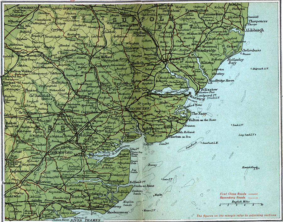
Description: A detailed travel map of southeastern England from 1908, showing portions of East and West Suffolk, and Essex counties. The map shows first class and secondary roads, railways, cities, towns, coastal and terrain features of the area. This map uses contour–coloring to show terrain, with elevations shown in feet. Cities on this map include Ipswich, Stowmarket, Colchester, Coggeshall, Braintree, Chelmsford, and Shoeburyness. Rivers and coastal features include River Thames, River Orwell, and River Blackwater, Oxfordness, the Naze, Foulness Point, and the lighthouses and lightvessels (Mouse, Swin, Gunfleet, Kentish Knock, Long Sand, Sunk, and Shipwash) moored in the Thames Estuary and along the coast.
Place Names: United Kingdom, Chelmsford, �Clare, �Essex, �Halstead, �Harwich, �Ipswich, �Stowmarket, �Sudbury, �Suffolk, �Witham,
ISO Topic Categories: inlandWaters,
location,
oceans,
transportation
Keywords: Essex and Suffolk, roads, �transportation, roads, inlandWaters,
location,
oceans,
transportation, Unknown, 1908
Source: J.G. Bartholomew, F.R.G.S., The Handy Touring Atlas of the British Isles Specially Prepared for Cyclists, Motorists, and Travellers (London, United Kingdom : George Newnes, Limited, 1908) 22-23
Map Credit: Courtesy the private collection of Roy Winkelman |
|