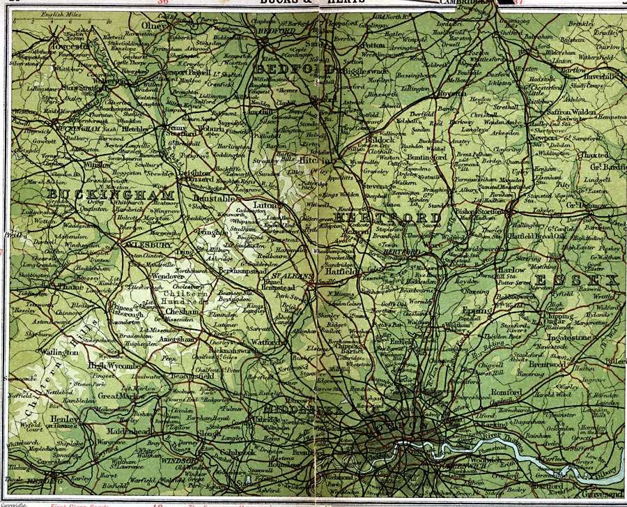
Description: A detailed travel map of England in 1908, showing portions of counties Bedford, Buckingham, Hertford, Essex, and Middlesex. The map shows first class and secondary roads, railways, cities, towns, rivers, and terrain features of the area. This map uses contour–coloring to show terrain, with elevations shown in feet. Cities on this map include London, Bedford, Hertford, Epping, Aylesbury, Reading, Windsor, Greenwich, and Gravesend. The River Thames and the Chiltern Hills are also shown.
Place Names: United Kingdom, Aylesbury, �Bedford, �Buckingham, �Bucks, �Cambridge, �Dunstable, �Epping, �Hertford, �Herts, �Luton, �Middlesex, �Olney, �St. Albans, �Windsor,
ISO Topic Categories: inlandWaters,
location,
oceans,
transportation
Keywords: Buckingham and Hertford, roads, �transportation, roads, inlandWaters,
location,
oceans,
transportation, Unknown, 1908
Source: J.G. Bartholomew, F.R.G.S., The Handy Touring Atlas of the British Isles Specially Prepared for Cyclists, Motorists, and Travellers (London, United Kingdom : George Newnes, Limited, 1908) 24-25
Map Credit: Courtesy the private collection of Roy Winkelman |
|