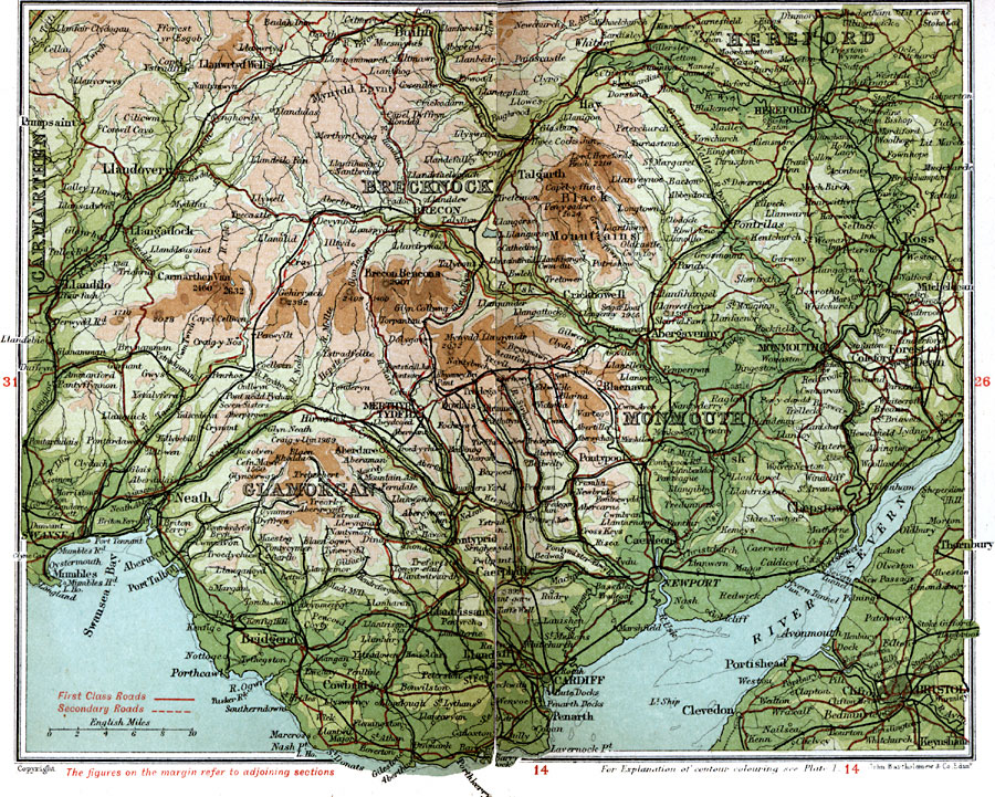
Description: A detailed travel map of southern Wales from 1908, showing portions of Carmarthen, Brecknock, Monmouth, and Glamorgen, and portions of Hereford in England. The map shows first class and secondary roads, railways, cities, towns, rivers, lakes, coastal and terrain features of the area. This map uses contour–coloring to show terrain, with elevations shown in feet. Cities on this map include Cardiff, Llandover, Builth, Breckon, Swansea, Neath, Bridgend, Chepstow, Monmouth, Ross, and Hereford. Rivers and coastal features include River Wye, River Bran, River Usk, River Mannow, River Severn, Swansea Bay, and the mountains Brecon Beacons, Cefn Mawr, Carmarthen Van, and the Black Mountains.
Place Names: United Kingdom, Brecknock, �Bristol, �Cardiff, �Carmarthen, �Glamorgan, �Hereford, �Monmouth, �South Wales, �Wale
ISO Topic Categories: inlandWaters,
location,
oceans,
transportation
Keywords: South Wales, roads, �transportation, roads, inlandWaters,
location,
oceans,
transportation, Unknown, 1908
Source: J.G. Bartholomew, F.R.G.S., The Handy Touring Atlas of the British Isles Specially Prepared for Cyclists, Motorists, and Travellers (London, United Kingdom : George Newnes, Limited, 1908) 28-29
Map Credit: Courtesy the private collection of Roy Winkelman |
|