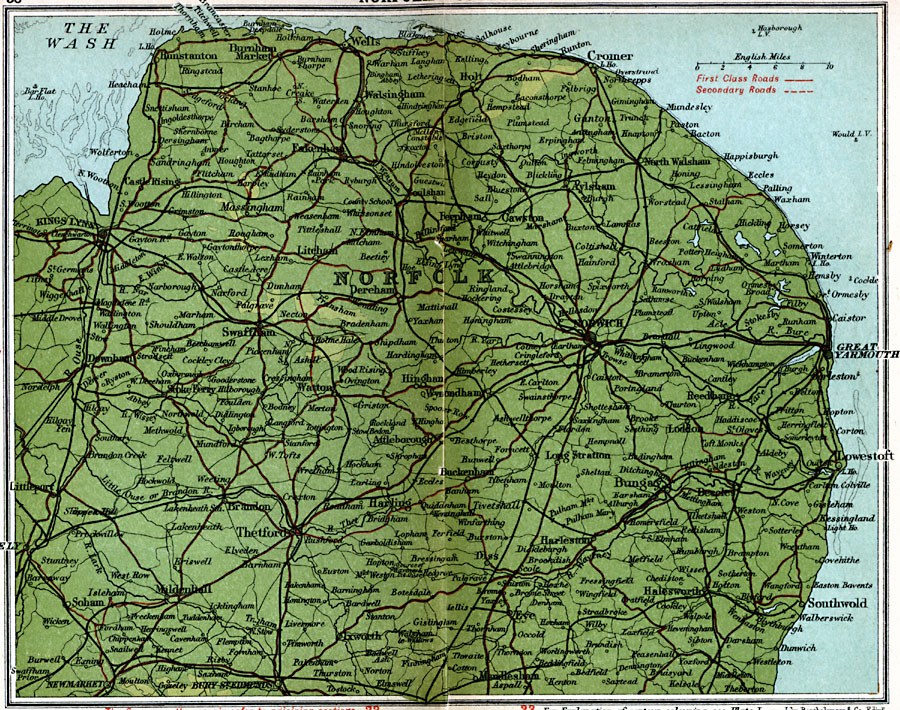
Description: A detailed travel map of eastern England from 1908, showing Norfolk County and the northern portions of Suffolk and Cambridge counties. The map shows first class and secondary roads, railways, cities, towns, coastal and terrain features of the area. This map uses contour–coloring to show terrain, with elevations shown in feet. Cities on this map include Norwich, Kings Lynn, Cromer, Great Yarmouth, Swaffham, Thetford, Southwold, and Newmarket. Rivers and coastal features include River Yare, River Waveney, Brandon River (Little Ouse), and southern portion of The Wash.
Place Names: United Kingdom, Eakenham, �Harting, �Norfolk, �Norwich, �Swaffham, �Thetford,
ISO Topic Categories: inlandWaters,
location,
oceans,
transportation
Keywords: Norfolk County, roads, �transportation, roads, inlandWaters,
location,
oceans,
transportation, Unknown, 1908
Source: J.G. Bartholomew, F.R.G.S., The Handy Touring Atlas of the British Isles Specially Prepared for Cyclists, Motorists, and Travellers (London, United Kingdom : George Newnes, Limited, 1908) 38-39
Map Credit: Courtesy the private collection of Roy Winkelman |
|