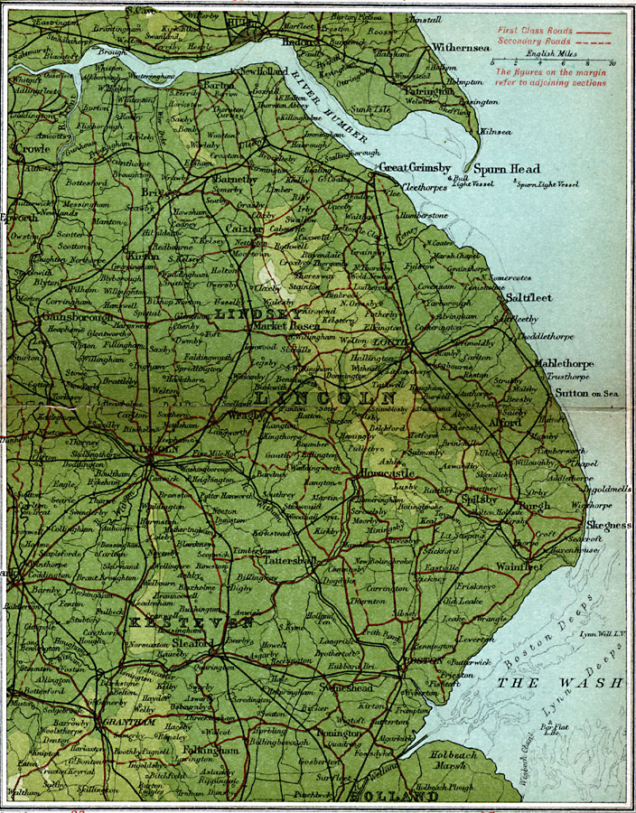
Description: A detailed travel map of Lincolnshire in eastern England from 1908, showing portions of Lincoln County and subdivisions of Lindsey, Kesteven, and Holland. The map shows first class and secondary roads, railways, cities, towns, coastal and terrain features of the area. This map uses contour–coloring to show terrain, with elevations shown in feet. Cities on this map include Hull, Withernsea, Great Grimsby, Gainsborough, Louth, Lincoln, Sleaford, and Grantham. Rivers and coastal features include River Humber, River Trent, The Wash, Holbeach Marsh, and Spurn Head.
Place Names: United Kingdom, Grantham, �Great Grimsby, �Holland, �Kesteven, �Lindsey, �Lincoln, �Louth, �Mablethorpe, �Saltfleet, �Sutton on Sea,
ISO Topic Categories: inlandWaters,
location,
oceans,
transportation
Keywords: Lincolnshire, roads, �transportation, roads, inlandWaters,
location,
oceans,
transportation, Unknown, 1908
Source: J.G. Bartholomew, F.R.G.S., The Handy Touring Atlas of the British Isles Specially Prepared for Cyclists, Motorists, and Travellers (London, United Kingdom : George Newnes, Limited, 1908) 40-41
Map Credit: Courtesy the private collection of Roy Winkelman |
|