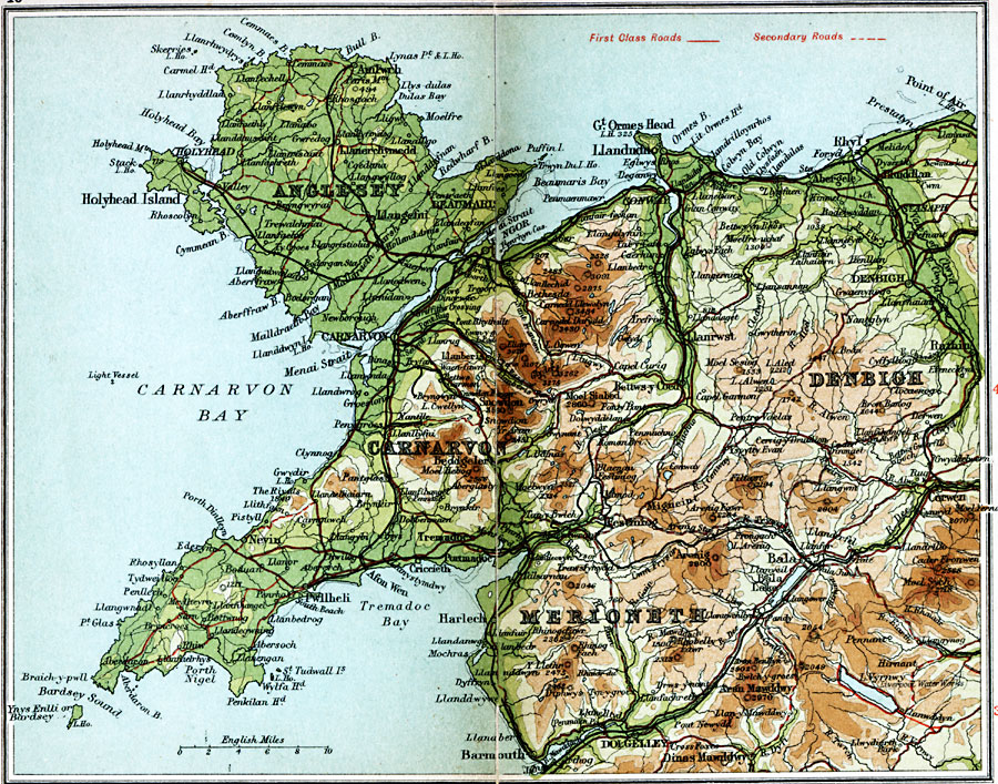
Description: A detailed travel map of northern Wales from 1908, showing the island of Anglesey, and portions of Carnarvon, Denbigh, and Merioneth. The map shows first class and secondary roads, railways, cities, towns, rivers, lakes, coastal and terrain features of the area. This map uses contour–coloring to show terrain, with elevations shown in feet. Cities on this map include Holyhead, Carnarvon, Conway, Llandudno, Rhyle, Denbigh, Harlech, Bala, and Dolgelley. Rivers and coastal features include River Mawddach, River Clwyd, Carnarvon Bay, Braich–y–pwll, and the mountains Arran Mawddy, Moel Sych, Carnedd Dafydd, and Snowden.
Place Names: United Kingdom, Anglesey, �Carnarvon, �Denbigh, �Dolgelley, �Holyhead Island, �Merioneth, �North Wales, �Wale
ISO Topic Categories: inlandWaters,
location,
oceans,
transportation
Keywords: North Wales, roads, �transportation, roads, inlandWaters,
location,
oceans,
transportation, Unknown, 1908
Source: J.G. Bartholomew, F.R.G.S., The Handy Touring Atlas of the British Isles Specially Prepared for Cyclists, Motorists, and Travellers (London, United Kingdom : George Newnes, Limited, 1908) 46-47
Map Credit: Courtesy the private collection of Roy Winkelman |
|