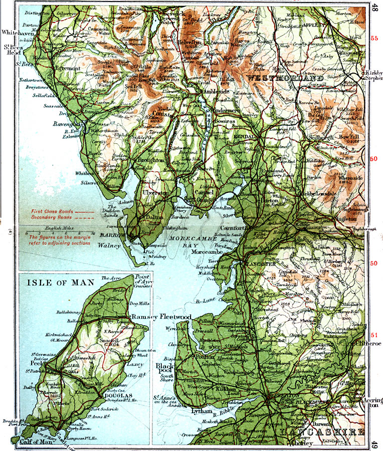
Description: A detailed travel map of western England around the Lake District and the Isle of Man from 1908, showing portions Westmoreland and Lancashire counties. The map shows first class and secondary roads, railways, cities, towns, coastal and terrain features of the area. This map uses contour–coloring to show terrain, with elevations shown in feet. Cities on this map include Whitehaven, Kendal, Kirkby, Kendal, Barrow, Lancaster, Fleetwood, Preston, and Chorley. Rivers, lakes, and coastal features include River Ribble, River Lune, Lake Windermere, Ullswater, Derwent Water, St. Bees Head, Morecambe Bay, and the mountains Helvellyn, Bow Fel, and Old Man. Features from the inset map of the Isle of Man include the Calf of Man, Snaefel, and Point of Ayre, and the cities of Ramsey, Peel, and Douglas.
Place Names: United Kingdom, Accrington, �Clitheroe, �Fleetwood, �Isle of Man, �Lancashire, �Lancaster, �Morecambe, �Peel, �Westmorland, �Whitehave
ISO Topic Categories: inlandWaters,
location,
oceans,
transportation
Keywords: Lake District and Isle of Man, roads, �transportation, roads, inlandWaters,
location,
oceans,
transportation, Unknown, 1908
Source: J.G. Bartholomew, F.R.G.S., The Handy Touring Atlas of the British Isles Specially Prepared for Cyclists, Motorists, and Travellers (London, United Kingdom : George Newnes, Limited, 1908) 48-49
Map Credit: Courtesy the private collection of Roy Winkelman |
|