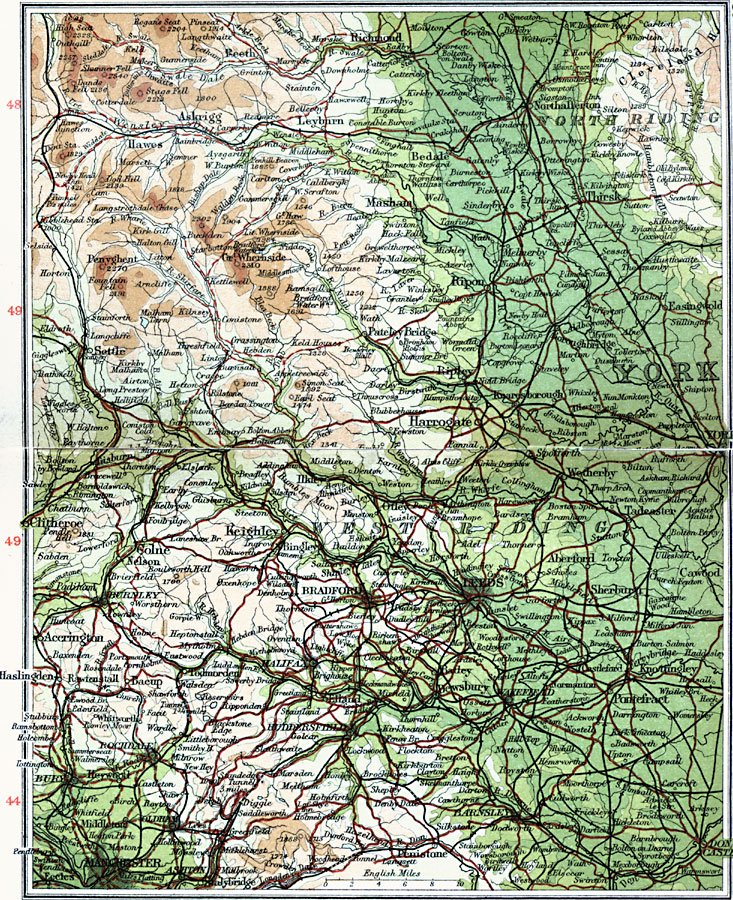
Description: A detailed travel map of West Yorkshire, England from 1908, showing North Riding and West Riding districts. The map shows first class and secondary roads, railways, cities, towns, and terrain features of the area. This map uses contour–coloring to show terrain, with elevations shown in feet. Cities on this map include York, Wakefield, Leeds, Bradford, Northallerton, Richmond, Ripon, Harrogate, Clitheroe, Halifax, and Manchester. Rivers include River Don, River Ouse, River Aire, and the mountains Rogan's Seat, Stags Fell, Great Whernside, and Penyghent.
Place Names: United Kingdom, Bradford, �Harrogate, �Keighley, �Leeds, �Manchester, �North Riding, �Skipton, �West Riding, �York,
ISO Topic Categories: inlandWaters,
location,
oceans,
transportation
Keywords: West Yorkshire, roads, �transportation, roads, inlandWaters,
location,
oceans,
transportation, Unknown, 1908
Source: J.G. Bartholomew, F.R.G.S., The Handy Touring Atlas of the British Isles Specially Prepared for Cyclists, Motorists, and Travellers (London, United Kingdom : George Newnes, Limited, 1908) 50-51
Map Credit: Courtesy the private collection of Roy Winkelman |
|