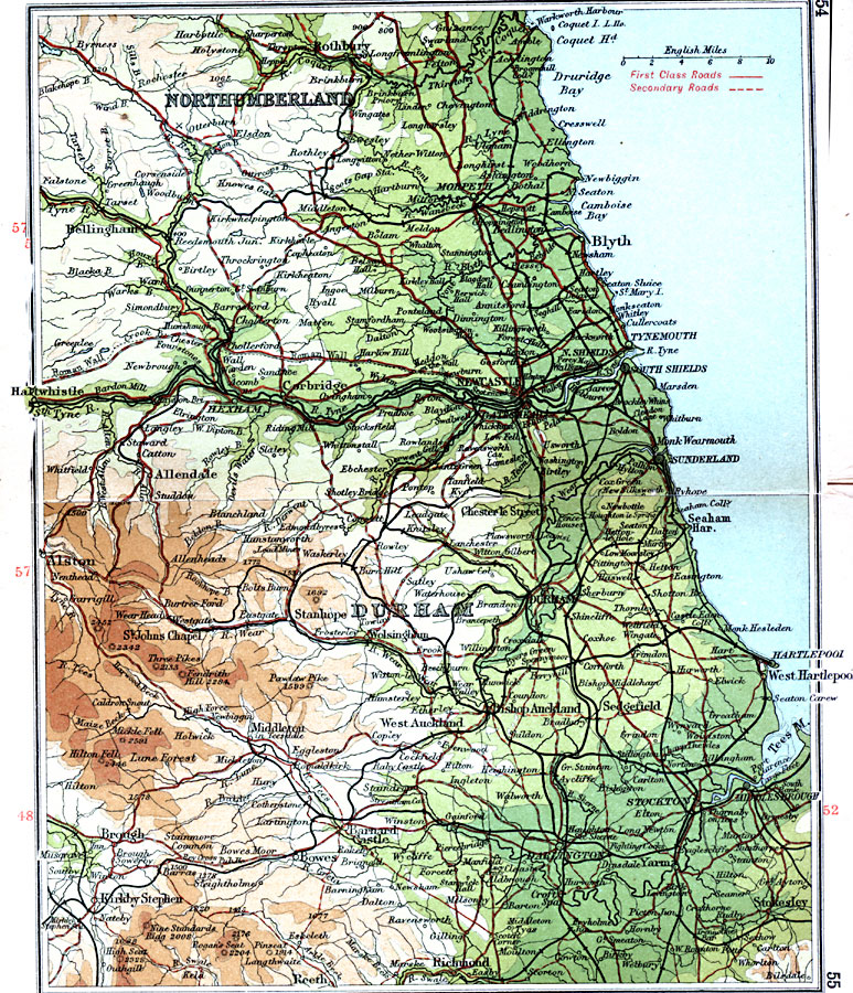
Description: A detailed travel map of England from 1908, showing portions of counties Northumberland and Durham. The map shows first class and secondary roads, railways, cities, towns, rivers, coastal and terrain features of the area. This map uses contour–coloring to show terrain, with elevations shown in feet. Cities on this map include Rothbury, Bellingham, Morpeth, Blyth, Haltwhistle, Newcastle, Durham, Stokesly, and Brough. Rivers include River Tees, River Wear, and River Tyne, and the mountains Three Pikes and Mickle Fell.
Place Names: United Kingdom, Alston, �Allendale, �Blyth, �Durham, �Newcastle, �Northumberland, �Stanhope, �West Hartlepoo
ISO Topic Categories: inlandWaters,
location,
oceans,
transportation
Keywords: Durham and Newcastle, roads, �transportation, roads, inlandWaters,
location,
oceans,
transportation, Unknown, 1908
Source: J.G. Bartholomew, F.R.G.S., The Handy Touring Atlas of the British Isles Specially Prepared for Cyclists, Motorists, and Travellers (London, United Kingdom : George Newnes, Limited, 1908) 54-55
Map Credit: Courtesy the private collection of Roy Winkelman |
|