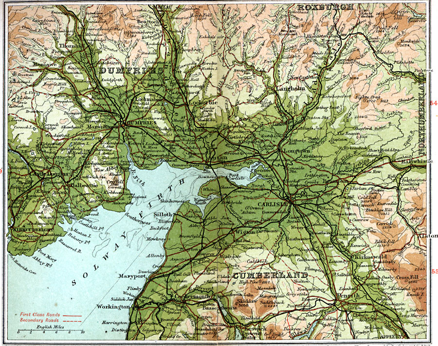
Description: A detailed travel map of northern England and southern Scotland around Solway Firth in 1908, showing portions of counties Roxburgh, Dumfries, Northumberland, and Cumberland. The map shows first class and secondary roads, railways, cities, towns, ports, rivers, terrain, and coastal features of the area. This map uses contour–coloring to show terrain, with elevations shown in feet. Cities on this map include Moffat, Dumfries, Lockerbie, Castle Douglas, Carlisle, Cockermouth, and Penrith. Rivers and coastal features include River Nith, River Dee, River Annan, River Eden, Solway Firth, Abby Head, and Wampool Mouth, and the mountains Queensberry, Loch Fell, Carter Fell, Cross Fell, and Skiddaw.
Place Names: United Kingdom, Carlisle, �Castle Douglas, �Cumberland, �Dumfries, �Langholm, �Roxburg
ISO Topic Categories: inlandWaters,
location,
oceans,
transportation
Keywords: Carlisle and Dumfries, roads, �transportation, roads, inlandWaters,
location,
oceans,
transportation, Unknown, 1908
Source: J.G. Bartholomew, F.R.G.S., The Handy Touring Atlas of the British Isles Specially Prepared for Cyclists, Motorists, and Travellers (London, United Kingdom : George Newnes, Limited, 1908) 56-57
Map Credit: Courtesy the private collection of Roy Winkelman |
|