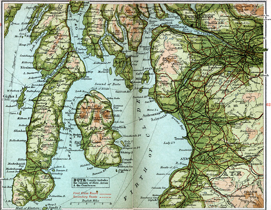
Description: A detailed travel map of southwestern Scotland from 1908, showing the area of the Firth of Clyde, with portions of counties Dumbarton, and Ayr, and the islands of County Bute (Bute, Arran, and the Cumbraes). The map shows first class and secondary roads, railways, cities, towns, ports, rivers, lakes, terrain and coastal features of the area. This map uses contour–coloring to show terrain, with elevations shown in feet. Cities on this map include Glasgow, Dumbarton, Kilmarnock, Ayr, Campbeltown, Tarbert, Rothesay, Brodick, and Lamlash. Rivers and coastal features include River Clyde, River Doon, Firth of Clyde, Kilbrennan Sound, and the mountains Goat Fell, Ben Tarsuinn, Campsie Fells, Kilpatrick Hills, and Enoch Hill.
Place Names: United Kingdom, Arran, �Ayr, �Bute, �Dumbarton, �Firth of Clyde, �Glasgow, �Kintyre, �Renfre
ISO Topic Categories: inlandWaters,
location,
oceans,
transportation
Keywords: Firth of Clyde, roads, �transportation, roads, inlandWaters,
location,
oceans,
transportation, Unknown, 1908
Source: J.G. Bartholomew, F.R.G.S., The Handy Touring Atlas of the British Isles Specially Prepared for Cyclists, Motorists, and Travellers (London, United Kingdom : George Newnes, Limited, 1908) 60-61
Map Credit: Courtesy the private collection of Roy Winkelman |
|