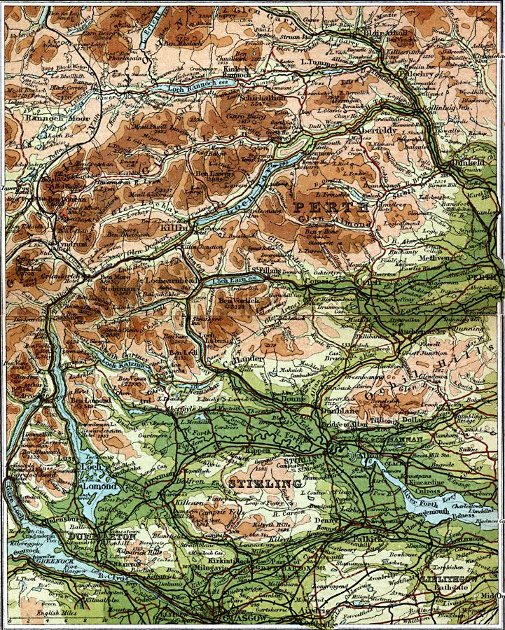
Description: A detailed travel map of Scotland from 1908, showing portions of counties Perth, Stirling, Clackmannan, Dumbarton, and Linlithgow. The map shows first class and secondary roads, railways, cities, towns, ports, canals, rivers, and terrain features of the area. This map uses contour–coloring to show terrain, with elevations shown in feet. Cities on this map include Glasgow, Blair Atholl, Dunkeld, Perth, Killin, Dunblain, Stirling, Bathgate, and Dumbarton. Rivers and lakes include River Clyde, River Dochart, River Earn, River Forth, Loch Lomond, Loch Tay, and Loch Earn, and the mountains Ben Lomond, Ben Ledi, Ben Vorlich, Ben Mholach, and the eastern Grampian Mountains.
Place Names: United Kingdom, Callender, �Dumbarton, �Linlithgow, �Lomond,�Ochil Hills, �Perth, �Perthshire, �Stirlin
ISO Topic Categories: inlandWaters,
location,
oceans,
transportation
Keywords: Central Perthshire, roads, �transportation, roads, inlandWaters,
location,
oceans,
transportation, Unknown, 1908
Source: J.G. Bartholomew, F.R.G.S., The Handy Touring Atlas of the British Isles Specially Prepared for Cyclists, Motorists, and Travellers (London, United Kingdom : George Newnes, Limited, 1908) 68-69
Map Credit: Courtesy the private collection of Roy Winkelman |
|