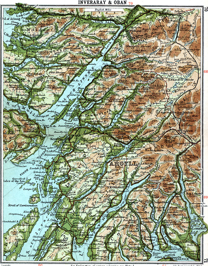
Description: A detailed travel map of western Scotland from 1908, showing portions of Argyll County and the islands of Mull and Jura. The map shows first class and secondary roads, railways, cities, towns, ports, ferry routes, rivers, lakes, terrain and coastal features of the area. This map uses contour–coloring to show terrain, with elevations shown in feet. Cities on this map include Fort William, Glen Coe, Kerrera, Dalmally, and Inverary. Rivers and coastal features include River Lochy, Loch Eil, Loch Sunart, Loch Linnhe, Strait of Mull, Loch Liven, Firth of Lorne, Strait of Jura, Loch Fyne, Loch Lomand, and the mountains Ben Nevis, Stob Ban, Cnoc Dearg, Ben Duran, Ben Lui, and Ben Lomond.
Place Names: United Kingdom, Ardgour, �Argyll, �Benderloch, �Cowall, �Inverary, �Lochabe, �Lorne, �Moidart, �Morven, �Oba
ISO Topic Categories: inlandWaters,
location,
oceans,
transportation
Keywords: Inverary and Oban, roads, �transportation, roads, inlandWaters,
location,
oceans,
transportation, Unknown, 1908
Source: J.G. Bartholomew, F.R.G.S., The Handy Touring Atlas of the British Isles Specially Prepared for Cyclists, Motorists, and Travellers (London, United Kingdom : George Newnes, Limited, 1908) 70-71
Map Credit: Courtesy the private collection of Roy Winkelman |
|