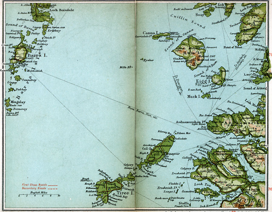
Description: A detailed travel map of the islands off the western coast of Scotland from 1908, showing the Barra Isles and the islands of Rum, Eigg, Canna, Coll, and Tiree. This map shows first class and secondary roads, cities, towns, ports, ferry and steamer routes, rivers, terrain and coastal features of the area. This map uses contour–coloring to show terrain, with elevations shown in feet.
Place Names: United Kingdom, Barra, �Eigg, �Mull, �Rum,
ISO Topic Categories: inlandWaters,
location,
oceans,
transportation
Keywords: Rum, Eigg, Barra, roads, �transportation, roads, inlandWaters,
location,
oceans,
transportation, Unknown, 1908
Source: J.G. Bartholomew, F.R.G.S., The Handy Touring Atlas of the British Isles Specially Prepared for Cyclists, Motorists, and Travellers (London, United Kingdom : George Newnes, Limited, 1908) 74-75
Map Credit: Courtesy the private collection of Roy Winkelman |
|